QGIS 3.14 Tutorial ।। Create contour and DEM ।। Google Earth ।। Geospatial Information Hub
Learn how to create Contour and DEM in QGIS 3.14 (PI) step by step.
Use this website to convert kml file to convert and add elevation data:
https://www.gpsvisualizer.com/elevation
Follow us on facebook:
https://www.facebook.com/GeospatialHub/
Видео QGIS 3.14 Tutorial ।। Create contour and DEM ।। Google Earth ।। Geospatial Information Hub канала Geospatial Information Hub
Показать
Комментарии отсутствуют
Информация о видео
Другие видео канала
 Very High Resolution DEM and Contour from Google Earth || Q GIS 3.14 || Detailed Hands-on ||
 How to Make a Map using QGIS3
 Most easy way to EXTRACT CONTOURS from GOOGLE EARTH directly in AUTO CAD using GLOBAL MAPPER
 Map and Compass (Simplified)
 How to create a 3D Terrain with Google Maps and height maps in Photoshop - 3D Map Generator Terrain
 QGIS Terrain Analysis: hillshade, slope, aspect (Version 3.x)
 QGIS Import XYZ coordinates data, Create DEM, Create contours, Add Contours label, Use 3D view model
 Extracting Elevation Data from Google Earth
 Deriving River Network & Catchments from a DEM using QGIS
 Stream and catchment delineation in QGIS 3
 QGIS 3 for Absolute Beginners
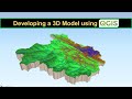 Developing a 3D Model using QGIS
 An Absolute Beginner's Guide to QGIS 3
 QGIS TIN Interpolation & Contour Extraction
 How To Create Contour From Google Earth
 QGIS Add Google Satellite, Hybrid, Maps, Terrain and other custom basemaps (Version 3.x )
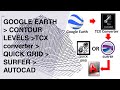 How to Convert GOOGLE EARTH CONTOURS to AUTOCAD by TCX converter + QUICK GRID or SURFER (DEM)
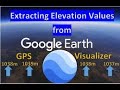 HOW TO EXTRACT ELEVATIONS FROM GOOGLE EARTH AND CREATE CONTOURS IN QGIS
 Importing CSV (Excel) Coordinates into QGIS
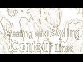 QGIS User 0027 - Styling Contour Lines