Cloud Compare tips
Stantec has certified drone pilots, and currently uses pix4D to photogrammetrically process point clouds from aerial photography.
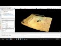
This example shows the very simple Cloud-Compare processing tools to
remove vegetation
resample / simplify your point cloud
run contour plots
Видео Cloud Compare tips канала LeeFluff
This example shows the very simple Cloud-Compare processing tools to
remove vegetation
resample / simplify your point cloud
run contour plots
Видео Cloud Compare tips канала LeeFluff
Показать
Комментарии отсутствуют
Информация о видео
Другие видео канала
 CloudCompare Basics 1
 Cloud Compare - Point List Picking tool
 Cloud Compare - Trace a polyline in a point cloud
 Cloud Compare Tutorial - Making nice maps, sections and colourful pictures
 Cloud Compare cloud simplification for DTM
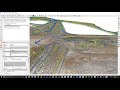 Automated Slope Breakline Classification with CloudCompare
 Videotutorial básico CloudCompare: caso práctico de talud en el embalse de Loriguilla (España)
 Cloud Compare - Properties and Scalar Field
 3D point clouds from drone imagery -- WebODM, Meshlab, GRASS 7.4
 Introductory Video on CloudCompare
 ZEB-1 and CloudCompare. Shaft's mesh creation
 CloudCompare Tutorial 02 - CloudCompare Display Options
 Demo of Discontinuity Set Extractor software
 3D Laser Scanning - Meshing Point Clouds in Cloud Compare
 How To Remove Vegetation and Create Contour Lines in CloudCompare
![Cómo visualizar y editar nubes de puntos en CloudCompare - [Aerial Insights]](https://i.ytimg.com/vi/nD90QryxI4c/default.jpg) Cómo visualizar y editar nubes de puntos en CloudCompare - [Aerial Insights]
Cómo visualizar y editar nubes de puntos en CloudCompare - [Aerial Insights] Lidar360 & Cloud Compare - Remove Noise
 How to merge drone images with terrestrial laser scans inside of RealityCapture.
 Nuvole di punti - classificazione e rimozione vegetazione con Cloud Compare
 Canopy Height Model CHM from Air LiDAR with Cloudcompare