3D point clouds from drone imagery -- WebODM, Meshlab, GRASS 7.4
In this tutorial, I show you how to use WebODM to create a 3D pointcloud, textured mesh, and referenced orthophoto from drone imagery. I then show you how to view output textured mesh in MeshLab. Finally, I show you how to create a DSM and DEM of the data in GRASS 7.4.
Видео 3D point clouds from drone imagery -- WebODM, Meshlab, GRASS 7.4 канала Isaac Ullah
Видео 3D point clouds from drone imagery -- WebODM, Meshlab, GRASS 7.4 канала Isaac Ullah
Показать
Комментарии отсутствуют
Информация о видео
Другие видео канала
 Bova Marina Archaeological Project -- Historic Households Survey Drone Video
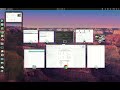 Introduction to Multiband imagery in GRASS 8 - False Color and NDVI
 Intro to GRASS 7.6, Vector Buffers, and QGIS-GRASS plugin
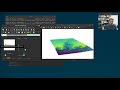 Terrain analysis in GRASS 7.6
 GRASS 7.4 Terrain Analysis and 3D view
 RLIC Project - 3D pointcloud of structure recorded with Livox Avia.
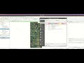 QGIS 3.22 - Thematic Mapping and the Print Layout editor
 ANTH 302 -Lab 6 tutorial - archaeological stratigraphy and the Harris Matrix
 GRASS 7.2 Tutorial - Using the mapcalc and predictive modeling
 3 quick additional tips for Thematic Mapping in QGIS 3.22
 Visibility Analysis in GRASS 8
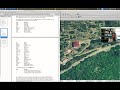 QGIS 2.18 -- Digitizing Vector Lines
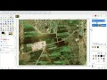 Bonus Lesson _ Qualitative Supervised Classification in GIMP
 Exploring an 18th century rural estate in Calabria.
 Grass 7.4 - Visibility Analysis and Vector Querying
 GRASS 7 2 - Landsat Images - False color - NDVI - Pansharpening
 Preserving the Past for an Uncertain Future: Accessible Methods 3-D Cultural Heritage Preservation
 gSuite productivity hacks!
 GRASS 7.2 - Unsupervised Image Classification
 How to do formal modeling experiments
 QGIS 3.22 - Vector queries and spatial operations