Image of the Week - Cold War Craters in Nevada
One of the most cratered landscapes on Earth is part of the Nevada Desert called Yucca Flat. Landsat 8's near-infrared and short wave infrared imaging shows the pockmarked surface perhaps more reminiscent of other planetary bodies than Earth.
The craters are relics from decades of nuclear tests conducted by the U.S. government since the early Cold War. An aerial photo from the USGS EROS archive shows that nuclear testing had already begun by 1952, but the largest crater had not yet appeared.
On July 6th, 1962 the Department of Energy detonated a 104 kiloton nuclear device as part of the Plowshare Program which explored the feasibility of non-combat uses of nuclear devices. The result was the Sedan Crater, shown in this declassified satellite image from 1965, and still visible in Landsat imagery today.
Video Credits: Brian Hauge (Contractor to USGS EROS Center), Video & Animation Specialist
Download Video: https://www.usgs.gov/media/videos/image-week-cold-war-craters-nevada
Видео Image of the Week - Cold War Craters in Nevada канала USGS
Показать
Комментарии отсутствуют
Информация о видео
Другие видео канала
 Image of the Week - 3 Decades of Lithium in Chile
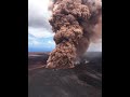 Largest Gravity Changes Ever Recorded: 2018 Kīlauea Eruption
 Mount St. Helens' Runaway Glacier: A time-lapse video of Crater Glacier
 What Does a USGS Hydrologic Technician Do to Inspect Streamgages?
 Monthly update of activity at Yellowstone Volcano for June 2021
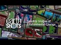 EarthShots — Satellite Images of Environmental Change
 Colorado River: Spring Disturbance Flow
 Water appears in Halemaʻumaʻu - Kīlauea Volcano
 Mount St. Helens: May 18, 1980
 Studying How the Beach Changes at Madeira Beach, Florida
 Hydropower in Ethiopia
 Time-lapse Photography of Barter Island in Alaska
 Kīlauea Summit Eruption | Lava Returns to Halemaʻumaʻu
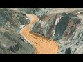 The Mojave River: A 3D Journey
 Lake Mead: Clear and Vital
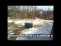 Ice breakup on the Skunk River at Augusta, IA
 What Does a USGS Hydrologic Technician Do
 The Yellowstone Volcano: Past, Present and Future
 Sampling the water in Halema'uma'u - Kīlauea Volcano
 We are the Coastal and Marine Hazards and Resources Program