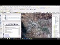
Automatic cloud Masking of Sentinel 2 Imagery Using ESA SNAP
How to perform automatic masking of Sentinel 2 Imagery using ESA SNAP Software
get the ESA SNAP software at : https://step.esa.int/main/toolboxes/snap/
and the data at : https://earthexplorer.usgs.gov
another example of cloud masking using Landsat-8 and Fmask : https://youtu.be/RdsglkHuZCU
Music by : wwww.bensound.com
Видео Automatic cloud Masking of Sentinel 2 Imagery Using ESA SNAP канала GEO 2004
Показать
Комментарии отсутствуют
Информация о видео
Другие видео канала
 Downloading and preprocessing Sentinel 2 images using the Semi-Classification Plugin in QGIS 3.0
 mosaicing, subsetting and masking raster datasets in SNAP
 ESA Echoes in Space - Geometry: Introduction to SNAP
 Download Sentinel-2 Imagery (10m resolution) for Free
 RUS Webinar: Burned area mapping with Sentinel-2 - HAZA02
 (03) Curso de procesamiento de imágenes Sentinel con SNAP –Funciones básicas de SNAP–
 QGIS - Cloud Masking
 DEM Creation from Sentinel 1 Imagery using SAR Interferometry Approach
 PSI using SNAP-STAMPS platform in WSL part 1
![[Tutorial Google Earth Engine] Cloud Masking Citra Satelit Sentinel-2A](https://i.ytimg.com/vi/U5j6pOndRTA/default.jpg) [Tutorial Google Earth Engine] Cloud Masking Citra Satelit Sentinel-2A
[Tutorial Google Earth Engine] Cloud Masking Citra Satelit Sentinel-2A Sentinel 2 preprocesssing with SNAP
 3D Realistic Visualization of Water Body Features in ArcGIS Pro
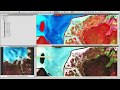 Exploring Sentinel-2 multi-spectral band combinations in SNAP
 Downloading satellite data | burdGIS
 Cloud Masking, Image Mosaic, and Land Cover Change Location
 Two Min Tip | Masking Out Cloud in Sentinel-2 Imagery
 RUS Webinar: Urban Heat Island with Sentinel-3 - LAND09
 removing clouds from aerial photographs/satellite imagery in ArcGIS
 ESA Echoes in Space - Hazard: Flood mapping with Sentinel-1
 ESA Echoes in Space - Geometry: Sentinel-1 Data Access