ESA Echoes in Space - Geometry: Sentinel-1 Data Access
Dr. Chris Stewart explains how to access and download Sentinel data form the Copernicus Open Access Hub
https://scihub.copernicus.eu/
Echoes in Space is the first Massive Open Online Course on Radar Remote Sensing, funded by the European Space Agency (ESA).
Register now: https://eo-college.org
Echoes from space will take you on a journey through the exciting world of Radar Remote Sensing. Learn the basics that will help you to understand where this technology is coming from, how the images are acquired and which manifold applications already use Radar Remote Sensing to help protect our planet.
Видео ESA Echoes in Space - Geometry: Sentinel-1 Data Access канала EO College
Показать
Комментарии отсутствуют
Информация о видео
Другие видео канала
 ESA Echoes in Space - Geometry: Introduction to SNAP
 ESA Echoes in Space - Hazard: Flood mapping with Sentinel-1
 ESA Echoes in Space - Land: Crop type mapping with Sentinel-1
 How to use the FEMA flood map search
 ESA Echoes in Space - Land: Forest mapping with ALOS PalSAR
 Soil Moisture Estimation - Practical: Use in situ data to estimate soil moisture from Sentinel-1
 Tutorial 1 - Downloading sentinel data from the Copernicus Open Access Hub
 ESA Echoes in Space - Hazard: Volcanic eruption mapping with Sentinel-1
 How to Visualise Sentinel 3 Data
 Simple Steps to Download Many Scenes of Sentinel Satellite Imagery from Copernicus Hub
 Sentinel Hub Webinar: Multi-Temporal Scripts and Data Fusion
 SAR Data Processing and Analysis
 Sentinel 1 SAR data for vegetation monitoring
 ESA Echoes in Space - Land: Urban Footprint mapping with Sentinel-1
 DEM Creation from Sentinel 1 Imagery using SAR Interferometry Approach
 How To Import GIS Shapefiles in Google Earth Pro
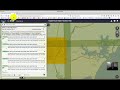 Downloading Sentinel Imagery Via Copernicus Open Access Hub
 Download Sentinel-2 from ESA - Εικόνες Sentinel-2 από την ESA
 How To Download Sentinel-1 SAR Data
 RUS Webinar: Rice Detection with Sentinel-1 using SNAP GPT - LAND10