Earth As Art 3
The Earth As Art project began in the early 2000s, and its original intent remains the same: to produce images that do not look like satellite images at first glance.
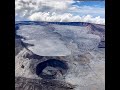
Earth As Art shows not only what satellites capture in the visible wavelengths of light you and I can see, but also what’s hiding in the invisible wavelengths that Landsat sensors can detect in the infrared part of the electromagnetic spectrum. Those combinations can bring out much more scientific value, but also can produce imagery of breathtaking beauty.
Download these images for free: https://eros.usgs.gov/image-gallery/earth-art
Videographer: USGS EROS Center, eroscommunications@usgs.gov
Additional Credits: Ben De Groot, contractor, USGS EROS
Video download: https://www.usgs.gov/media/videos/earth-art-3
Видео Earth As Art 3 канала USGS
Показать
Комментарии отсутствуют
Информация о видео
Другие видео канала
 When will Mauna Loa erupt next?
 YVO monthly update of activity at Yellowstone Volcano, May 1, 2022
 What Does a USGS Hydrologic Technician Do to Inspect Streamgages?
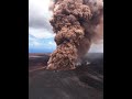 Largest Gravity Changes Ever Recorded: 2018 Kīlauea Eruption
 Mount Rainier Lahars: Hazards for the Puyallup and Nisqually River Drainages
 Mount St. Helens: May 18, 1980
 Colorado River: Spring Disturbance Flow
 Earth as Art 2
 Kīlauea summit overflight video – May 10, 2022
 Lesson 7a - EarthExplorer Introduction
 PubTalk 5/2021 - Where Earthquakes Hide in the Desert
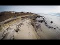 USGS Coastal Change Hazards
 Monthly update of activity at Yellowstone Volcano for June 2021
 An overview of landslide hazards in Idaho
 YVO monthly activity update from rim of Yellowstone's Grand Canyon!
 Lava lake at Kīlauea summit on April 26, 2022
 Yellowstone Volcano Observatory Monthly Update for January 2021
 The building and upkeep of landslide hazards program: Blue Ridge perspective on a national challenge
 PubTalk-04/2022 - A Burning Question: What can long-term datasets teach us?