Lesson1 Easy QGIS Tutorial For Absolute Beginners
This video aims to make the beginners familiar with QGIS window and adding layers in it. The map of India is used for the purpose. The layers used in the video can be fetched from https://www.diva-gis.org.
Feel free to add queries or correct me. Cheers.
Note: The shapefile used in the tutorial is not true representation of Indian map. This is for learning purpose only.
For adding symbology and labels : https://youtu.be/m2VOnLVTNH4
For making QGIS Layout map: https://youtu.be/cI2k41I-tgM
For preparation of NDVI map: https://youtu.be/gnfPkG9-lzg
#QGIS #Introduction #Beginners #Mapping #India
Видео Lesson1 Easy QGIS Tutorial For Absolute Beginners канала Pankaj Adhikari
Показать
Комментарии отсутствуют
Информация о видео
Другие видео канала
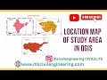 HOW TO CREATE LOCATION MAP OF STUDY AREA IN QGIS | HOW TO DOWNLOAD FREE SHAPEFILE AND ADD LAYERS
 Importing CSV (Excel) Coordinates into QGIS
 An Absolute Beginner's Guide to QGIS 3
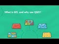 Demo 1 - What is GIS, and why use QGIS?
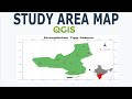 Prepare Study Area Map Easily |QGIS
 QGIS for Beginners
 QGIS 3.10 BASICS - Lesson 1 - Setup
 QGIS Geoprocessing Tools (Buffer and Clip) for #TheGreenSpace
 Change Detection Analysis of Land use Land cover (LULC) Classification in QGIS
 QGIS Georeferencing Google Earth Images
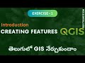 QGIS for Beginners (Exercise 1 Creating Shapefiles) / GIS in Telugu
 QGIS for absolute beginners part 1 in Amharic
![QGIS complete tutorial for beginners. QGIS for beginners [2021]](https://i.ytimg.com/vi/d15Xl4OphDk/default.jpg) QGIS complete tutorial for beginners. QGIS for beginners [2021]
QGIS complete tutorial for beginners. QGIS for beginners [2021] How to Add Excel file CSV with Shape file in QGIS 2021 ENGLISH
 QGIS 3 for Absolute Beginners
 QGIS For Absolute Beginners || QGIS Tutorials For Beginner || GeoFox
 Demo of QGIS Software : Adding GIS Data, Attribute table & Identity tool Change symbology,
 QGIS Part4 - How to create your first map in 15 mins
 Lesson 1: Introduction to QGIS Tutorial in Hindi for Absolute Beginners
 How to Download Vector Data from OpenStreetMap using QGIS