Generate stream order in QGIS using DEM || Create a stream order map
Here in this tutorial, I will be creating a stream order map in QGIS using a DEM (Digital Elevation Model). You can follow the given link to download the DEM to practice along with the video
https://drive.google.com/file/d/1NBUgyYZETlHhXdL6zTg2K3Lob3lCKK8m/view?usp=sharing
For the video lecture on introduction to stream order, you can follow this link. https://youtu.be/UJaBkNRFY_g
Happy learning
Please like and share the video. Subscribe the channel as well.
Let’s remove the barrier in education!!
Happy learning
Видео Generate stream order in QGIS using DEM || Create a stream order map канала QGIS WORLD
Показать
Комментарии отсутствуют
Информация о видео
Другие видео канала
 Deriving River Network & Catchments from a DEM using QGIS
 QGIS : Generate Stream using Strahler order calculation
 Stream and catchment delineation in QGIS 3
 Creating Geologic Map in QGIS
 How to create contours using DEM in QGIS || Generate contours from DEM
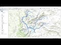 Stream Order from a Digital Elevation Model (DEM) using ArcGIS
 QGISHydro Webinar 4: Stream & Catchment Delineation
 Study area Map using QGIS
 How to use WhiteboxTools in QGIS?
 IMD rainfall data: NetCDF file to interpolation for India || Convert NetCDF to raster in ArcMap
 water outlet _ strahler order QGIS
 How To Draw Lines In Photoshop - 3 Best Tools
 River Stream Order Map in ArcGIS | ArcGIS Tutorial 28
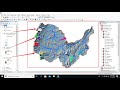 Hydrological modeling in ArcGIS / ArcMap
 How to use a DEM to delineate a Watershed/Basin in ArcGIS
 Developing a 3D Model using QGIS
 HOW TO DELINEATE WATERSHED IN QGIS | DERIVE STREAM NETWORK & ADD AN OUTLET POINT USING QGIS | VLOG
 Generate DEM from contours in QGIS
 Calculating Statistically Significant Hotspots Using the Hotspot Analysis Plugin in QGIS
 Watershed Delineation using DEM in QGIS