Supervised Classification: Training Samples, Classification, and Land Cover Change Analysis
This video guides you through the entire process of supervised classification in remote sensing. You will learn how to import satellite images, select and create training samples, and classify land cover based on known classes. The tutorial covers important steps such as image preprocessing, defining spectral signatures, and performing supervised classification to map different land cover types. Additionally, the video demonstrates how to create a professional map layout with a scale, legend, and title. Finally, you'll analyze land cover changes over time using Excel for a quantitative assessment of environmental transformations.
Видео Supervised Classification: Training Samples, Classification, and Land Cover Change Analysis канала Geomatics Planet
Видео Supervised Classification: Training Samples, Classification, and Land Cover Change Analysis канала Geomatics Planet
Supervised Classification Remote Sensing Land Cover Classification GIS Mapping Image Import Training Samples Spectral Signatures Land Cover Change Supervised Classification Workflow ArcMap GIS Analysis Environmental Monitoring Remote Sensing Analysis Spatial Data Map Layout Adding Scale and Legend Land Use Change Analysis GIS Excel Analysis Remote Sensing Workflow Classification Techniques
Комментарии отсутствуют
Информация о видео
11 октября 2024 г. 13:25:51
00:58:12
Другие видео канала
 Matplotlib in PyCharm with Jupyter Lab: Grid Lines and Subplots
 Highlighting the Active Cell in Excel
 Creating an Inventory Tracker in Excel
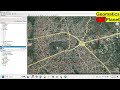 Topographic Mapping: Extracting Contours and Data Integration with OpenDEM, OpenTopography, BBBike
 HOW TO SELECT FEATURES BY USING FEATURES BUTTON IN ARCGIS
 Supervised Classification of Landsat 8 Imagery in ArcMap
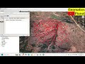 Extracting Elevation Data from Google Earth Pro to ArcGIS
 Basic Raster Operations and Elevation Analysis in ArcGIS
 Creating a Batch Folder in Excel Using .BAT
 Downloading Landsat 8 Satellite Imagery from USGS EarthExplorer Using KML/Shapefile & Polygon/Point
 Transpose Data in Excel Using the Paste Option
 Password Protect Your Documents in Microsoft Word or Excel
 Visual Positioning System
 Matplotlib: Bars, Histograms, and Pie Charts
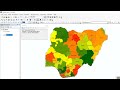 HOW TO MEASURE LENGTH AND AREA IN ARCGIS
 Joins and relates, Labeling, and Choropleth Maps in ArcMap and feature to point
 Calculating Percentages in Excel
 Creating a Study Area in ArcGIS/ArcMap
 Importing Web Data to Excel: Automatically Update Data from Web Sources
 Downloading Precipitation Data from Giovanni and Plotting with ArcMap & Panoply