Topographic Mapping: Extracting Contours and Data Integration with OpenDEM, OpenTopography, BBBike
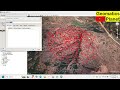
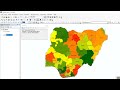
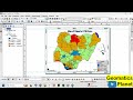
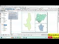
Detailed topographic maps by extracting contours from various sources like OpenDEM, OpenTopography, BBBike, and Google Earth. This comprehensive tutorial walks you through the process of extracting OpenStreetMap data, performing interpolation using kriging, and creating a fishnet for precise mapping. Finally, discover how to integrate all this data into ArcMap to produce a high-quality topographic map. Ideal for GIS professionals and mapping enthusiasts, this guide offers practical examples and clear instructions to elevate your topographic mapping skills.
BBBike : https://extract.bbbike.org/
OpenDEM: https://www.opendem.info/download_contours.html
OpenTopography: https://opentopography.org/
Видео Topographic Mapping: Extracting Contours and Data Integration with OpenDEM, OpenTopography, BBBike канала Geomatics Planet
BBBike : https://extract.bbbike.org/
OpenDEM: https://www.opendem.info/download_contours.html
OpenTopography: https://opentopography.org/
Видео Topographic Mapping: Extracting Contours and Data Integration with OpenDEM, OpenTopography, BBBike канала Geomatics Planet
Topographic Mapping OpenDEM OpenTopography BBBike Google Earth Contour Extraction OpenStreetMap Data Integration ArcMap GIS Kriging Interpolation Fishnet Creation Topographic Maps GIS Tutorial Step-by-Step Guide Geographic Information Systems Spatial Data Mapping Techniques GIS Tools Data Analysis GIS Software Advanced Mapping GIS Professionals Geospatial Data
Комментарии отсутствуют
Информация о видео
9 августа 2024 г. 15:47:07
00:51:00
Другие видео канала