Old Photographs St Kilda Scotland
Old photographs of St Kilda, Scotland. Often described as the islands at the edge of the world, the archipelago of St Kilda is located 41 miles west of North Uist in the Outer Hebrides. Now uninhabited, St Kilda was home to a community who survived the inhospitable conditions here for thousands of years before the final 36 people were evacuated in 1930. The islands were historically part of the domain of the MacLeods of Harris whose steward was responsible for the collection of rents in kind and other duties. Early in World War I the Royal Navy erected a signal station on Hirta and daily communications with the mainland were established for the first time in St Kilda's history. In a belated response, a German submarine arrived in Village Bay on the morning of 15 May 1918 and after issuing a warning, started shelling the island. Seventy two shells in all were fired and the wireless station was destroyed. The manse, church and jetty storehouse were also damaged but there was no loss of life. After World War One most of the young men left the island and the population fell from 73 in 1920 to 37 in 1928. After the death of four men from influenza in 1926, and a succession of crop failures in the 1920s, the last straw came with the death from appendicitis of a young woman, Mary Gillies, in January 1930. On 29 August 1930. On 29 August 1930, the last 36 inhabitants were evacuated to Morvern on the Scottish mainland at their own request.Now uninhabited, St Kilda was home to a community who survived the inhospitable conditions here for thousands of years before the final 36 people were evacuated in 1930.
Видео Old Photographs St Kilda Scotland канала tourscotland
Видео Old Photographs St Kilda Scotland канала tourscotland
Показать
Комментарии отсутствуют
Информация о видео
Другие видео канала
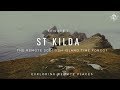 St Kilda Island Scotland - Exploring Remote Places - A Remote Island That Time Forgot
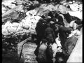 St Kilda Britains lonliest island (1928)
 Scotland | St Kilda | interviews with islanders | Documentary Report | 1972
 St Kilda: The Abandoned Scottish Archipelago || Hirta Island || Soay Island
 St Kilda The Movie 425ABCB5 AAB4 4C7C 80FF B417143F25D7
 Life On St Kilda Island, 1910 - Film 37331
 Remembering the Evacuation of St Kilda
 The Island Of St. Kilda (1908)
 The Last of the Blasket People.wmv
 Irish Famine
 St Kilda: A Wildlife Mystery
 Scotland's St Kilda
 Journey to St Kilda from Oban on MV Hjalmar Bjorge - June 2017
 My trip to St Kilda, 16th June 2009
 The Hebrides Revival, Trump's Bible and the Passing of the Torch
![Stunning Winter Drive in the Outer Hebrides; North Uist, Harris & Lewis [CC]](https://i.ytimg.com/vi/LWTM-sPAYgU/default.jpg) Stunning Winter Drive in the Outer Hebrides; North Uist, Harris & Lewis [CC]
Stunning Winter Drive in the Outer Hebrides; North Uist, Harris & Lewis [CC]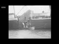 Evacuation of St Kilda
 We touched them! 👋🏼 Callanish Standing Stones | Isle Of Lewis, Scotland | Rabbies
 Crofters - A 1944 film showing life on Scottish crofts in wartime