How to use the Leica GS18 T GNSS RTK rover
The world’s fastest and easiest-to-use GNSS RTK rover with true tilt compensation for surveying. Measure and stake out points with no need to level the pole vertically. Quick and convenient, radically simplified staking out with a tilted pole.
Видео How to use the Leica GS18 T GNSS RTK rover канала Leica Geosystems AG
Видео How to use the Leica GS18 T GNSS RTK rover канала Leica Geosystems AG
Показать
Комментарии отсутствуют
Информация о видео
Другие видео канала
 Leica GS18 T – World’s fastest GNSS RTK rover
 How does land surveying work?
 Imaging
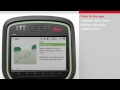 Overview of Stake Line and Stake Road apps
 Leica iCONstruct field solution
 GPS RTK Surveying Workshop
 TS/MS - Out of the box
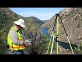 Best Practices for Minimizing Errors during GNSS Data Collection
 How to use SmartLink
 Introduction to robotic total stations
 Inspect a surface
 Active Tracking on a Trimble S5 Robot
 How to setup and use Trimble R10 survey unit
 Check & Adjust Calibration for Leica total stations and MultiStations
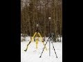 R10 2 GNSS Base and Rover setup
 Surveying 1 - Introduction to leveling
 GPS Surveying
 Tips& Tricks with the Leica CS20
 Reach RS/RS+ — RTK over LoRa radio
 Leica Infinity 2018