HOW TO USE LIDAR MAPS
The easy way to use Lidar maps when researching land for past history for new metal detecting land.
https://gridreferencefinder.com/
https://houseprices.io/lab/lidar/map
Видео HOW TO USE LIDAR MAPS канала EnglandsHistory
https://gridreferencefinder.com/
https://houseprices.io/lab/lidar/map
Видео HOW TO USE LIDAR MAPS канала EnglandsHistory
Показать
Комментарии отсутствуют
Информация о видео
Другие видео канала
 How to Import LiDAR Data into Google Earth
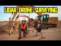 What is LiDAR Drone Surveying | Accuracies and Results
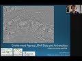 Using Open Source LiDAR for Archaeology
 GPAA Claims and LIDAR maps
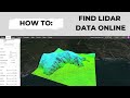 Where to find LiDAR data online? (USGS lidar point cloud in Equator)
 Archaeological Mapping from airborne LiDAR | Dr. Chris Smart | Virtual Café Sci
 New Imagery and LIDAR Capabilities in ArcGIS for National Mapping
 Making contours with the ROCK Surveyor APP and a LiDAR Drone
 Using lidar to study ecosystem dynamics; seeking the 5th dimension!
 Metal Detecting: 10 Tips to Get Metal Detecting Permissions
 Gold Prospecting with Lidar
 Working with Publicly Available LiDAR Data Sets for Road & Corridor Design
 How to create interactive maps in R? Leaflet and Mapdeck? 🗺️
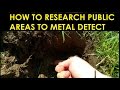 HOW TO RESEARCH PUBLIC AREAS FOR METAL DETECTING
 Introduction to Civil 3D Part 19 - Inserting LIDAR and Point Clouds into Civil 3D
 LiDAR Surface Models in ArcGIS Pro
 How To Make Money with Google Maps ($100-$200 PER DAY)
 Drone LiDAR vs Photogrammetry | Epic Stadium 3D model
 ROMAN DISCOVERIES FOUND IN UK