SARAi E-skwela on Satellite Remote Sensing: A smarter approach for agricultural monitoring
NOTE: Please email us at project.sarai.uplb@gmail.com if you want to have a copy of this video or if you will use this video for a certain purpose. This is for our documentation. Thank you very much!
Community Level - SARAi Ehhanced Agricultural Monitoring System can be used to monitor, on a near-real time and site-specific basis, the actual area planted to a crop and its condition based on free and daily updated satellite images (from US and Europe Union). It combines the use of remote sensing, normalized digital vegetation indices, on a geographic information system platform to generate maps showing the crop growth/health, damage estimates, production areas, among others. It makes the monitoring of large areas more efficient and faster.
Видео SARAi E-skwela on Satellite Remote Sensing: A smarter approach for agricultural monitoring канала Project SARAi
Показать
Комментарии отсутствуют
Информация о видео
Другие видео канала
 SARAi E-skwela on Drought from Space: Utilizing satellite data to monitor drought in the Philippines
 CFS Interview 1 080315
 SARAi E-skwela on CAPHE and Coffee Processing
 Know more about Project SARAI
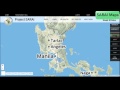 SARAI Interactive Maps and Real-time Data
 A Walkthrough to Project SARAI by Dr. Maria Victoria O. Espaldon (SARAI Program Leader)
 SARAi E-skwela Season 2 Episode 1: Recommended Agricultural Practices for Coconut
 SPIDTECH Introductory Video (Filipino)
 SARAI analysis of Taal Ashfall
 SARAi E-skwela S2 Episode 3 - Gabay sa Produksyon ng Soybean
 CSU Training
 SARAI Taal Ashfall Crop Advisory
 An Introduction: SARAI Real Time Weather Monitoring with Prof. Nelio Altoveros of IMSP, UPLB
 SARAi E-skwela - Improving Smallholder Access to Inst'l Markets by Training on Cacao Primary Process
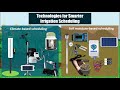 SARAi E-skwela on Smarter Technologies for Crop Water Management
 An Introduction: SARAI WAISS
 Cacao Primary Processing Technologies NSTW Davao Presentation
 SARAI SPIDTECH how to FILIPINO
 SARAI SPIDTECH how to ENGLISH
 Suitability Maps WARAY