- Популярные видео
- Авто
- Видео-блоги
- ДТП, аварии
- Для маленьких
- Еда, напитки
- Животные
- Закон и право
- Знаменитости
- Игры
- Искусство
- Комедии
- Красота, мода
- Кулинария, рецепты
- Люди
- Мото
- Музыка
- Мультфильмы
- Наука, технологии
- Новости
- Образование
- Политика
- Праздники
- Приколы
- Природа
- Происшествия
- Путешествия
- Развлечения
- Ржач
- Семья
- Сериалы
- Спорт
- Стиль жизни
- ТВ передачи
- Танцы
- Технологии
- Товары
- Ужасы
- Фильмы
- Шоу-бизнес
- Юмор
Blustery Coastal Winds and Showers PLUS a Low on the way to South Australia
Come follow me for behind-the-scenes photos and videos on Instagram! https://www.instagram.com/dailyforecastaustralia/
Bureau of Meteorology Warnings an Alerts: https://www.bom.gov.au/weather-and-climate/warnings-and-alerts
Thursday April 30, 2026 — Daily Forecast Australia
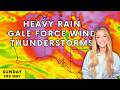
Today's weather is being shaped by two key systems — a large high pressure system transiting across the Tasman Sea and tracking east over New Zealand, and a developing low pressure system sitting offshore to the south of Western Australia. That high is maintaining a steady easterly fetch along the east coast, keeping conditions blustery along exposed coastal stretches, while the developing low to the west is beginning to draw moisture into southern parts of the country and spark showers and isolated storms.
The main rainfall focus today is offshore, where a cluster of organised showers and thunderstorms sits over the Coral Sea. Some of that activity may brush the coast between central Queensland and northern New South Wales, bringing occasional light showers to Brisbane, Coffs Harbour and surrounding coastal areas — but the more active storms are expected to remain offshore. In the west, patchy showers and scattered thunderstorms continue through the Goldfields and Esperance region, extending east toward the Nullarbor and western Eyre Peninsula.
Winds are one of the more notable features today. Queensland's coastal stretch continues to see gusts exceeding 60 km/h, with strong onshore winds from the tropical coast through Mackay, Capricornia and into the southeast. Strong winds are also affecting Bunbury, Albany and Esperance, and the Eyre Peninsula is picking up as that developing pressure difference tightens. Tasmania has coastal wind warnings current for the Far North West, South West and Central West coasts.
Looking ahead into the weekend, that developing low to the south of Western Australia edges closer to the coast as it tracks eastward, with a more active pressure pattern beginning to influence the Eyre and Yorke Peninsulas, the Adelaide and Mt Lofty Ranges, and outback South Australia.
Over the three-day outlook, the heaviest accumulations are focused across tropical Queensland, with Mackay, Innisfail and Cape Tribulation expected to pick up the highest totals. Coffs Harbour, Lismore and the Sunshine Coast continue to see persistent coastal falls, while light accumulations spread into the Eyre Peninsula, outback New South Wales and northwest Victoria.
All active Bureau of Meteorology warnings are linked below. If you find this forecast helpful, please give it a thumbs up and drop a comment below — it really helps spread the word about the channel. Subscribe and hit the bell so you never miss a daily update.
My favourite portable weather station https://amzn.to/46PKhvM
My favourite at-home weather station https://amzn.to/4b7r2R3
Weather vane https://amzn.to/3Ncilvh
Outdoor rain gauge https://amzn.to/40XExMV
My daily sunscreen https://amzn.to/40fiCRg
00:00 Intro
00:28 Synoptic Chart
02:34 Rain & Thunderstorm Activity
04:17 Temperatures
07:35 Wind & Gust Predictions
09:34 Cloud and Satellite Imagery
11:35 Rain Accumulation
13:29 Wrap Up
Видео Blustery Coastal Winds and Showers PLUS a Low on the way to South Australia канала Daily Forecast Australia
Bureau of Meteorology Warnings an Alerts: https://www.bom.gov.au/weather-and-climate/warnings-and-alerts
Thursday April 30, 2026 — Daily Forecast Australia
Today's weather is being shaped by two key systems — a large high pressure system transiting across the Tasman Sea and tracking east over New Zealand, and a developing low pressure system sitting offshore to the south of Western Australia. That high is maintaining a steady easterly fetch along the east coast, keeping conditions blustery along exposed coastal stretches, while the developing low to the west is beginning to draw moisture into southern parts of the country and spark showers and isolated storms.
The main rainfall focus today is offshore, where a cluster of organised showers and thunderstorms sits over the Coral Sea. Some of that activity may brush the coast between central Queensland and northern New South Wales, bringing occasional light showers to Brisbane, Coffs Harbour and surrounding coastal areas — but the more active storms are expected to remain offshore. In the west, patchy showers and scattered thunderstorms continue through the Goldfields and Esperance region, extending east toward the Nullarbor and western Eyre Peninsula.
Winds are one of the more notable features today. Queensland's coastal stretch continues to see gusts exceeding 60 km/h, with strong onshore winds from the tropical coast through Mackay, Capricornia and into the southeast. Strong winds are also affecting Bunbury, Albany and Esperance, and the Eyre Peninsula is picking up as that developing pressure difference tightens. Tasmania has coastal wind warnings current for the Far North West, South West and Central West coasts.
Looking ahead into the weekend, that developing low to the south of Western Australia edges closer to the coast as it tracks eastward, with a more active pressure pattern beginning to influence the Eyre and Yorke Peninsulas, the Adelaide and Mt Lofty Ranges, and outback South Australia.
Over the three-day outlook, the heaviest accumulations are focused across tropical Queensland, with Mackay, Innisfail and Cape Tribulation expected to pick up the highest totals. Coffs Harbour, Lismore and the Sunshine Coast continue to see persistent coastal falls, while light accumulations spread into the Eyre Peninsula, outback New South Wales and northwest Victoria.
All active Bureau of Meteorology warnings are linked below. If you find this forecast helpful, please give it a thumbs up and drop a comment below — it really helps spread the word about the channel. Subscribe and hit the bell so you never miss a daily update.
My favourite portable weather station https://amzn.to/46PKhvM
My favourite at-home weather station https://amzn.to/4b7r2R3
Weather vane https://amzn.to/3Ncilvh
Outdoor rain gauge https://amzn.to/40XExMV
My daily sunscreen https://amzn.to/40fiCRg
00:00 Intro
00:28 Synoptic Chart
02:34 Rain & Thunderstorm Activity
04:17 Temperatures
07:35 Wind & Gust Predictions
09:34 Cloud and Satellite Imagery
11:35 Rain Accumulation
13:29 Wrap Up
Видео Blustery Coastal Winds and Showers PLUS a Low on the way to South Australia канала Daily Forecast Australia
news abc abc news Heavy rain Thunderstorms australia Extreme weather weather Monsoon storm Australian Outback australia news 9news channel 9 australian news Climate Weather update Meteorology Weather forecast Australia weather cyclone oz weather channel channel 7 meteorologist outback aussie roadtrip nullarbor great ocean road floods qld lake eyre BoM daily forecast australia weather watch surf report queensland WA Perth Western Australia warning alert rain
Комментарии отсутствуют
Информация о видео
30 апреля 2026 г. 2:00:57
00:14:23
Другие видео канала