Leica RTC360 3D Reality Capture Solution in Budapest
The Leica RTC360 3D reality capture solution empowers users to document and capture their environments in 3D, improving efficiency and productivity in the field and in the office through fast, simple-to-use, accurate, and portable hardware and software. The RTC360 3D laser scanner is the solution for professionals to manage project complexities with accurate and reliable 3D representations and discover the possibilities of any site.
See the captured data in Leica TruView:
http://truview.emea.leica-geosystems.com/site/5b2fde30f494c70c86f36a9a?tab=sitemap
Видео Leica RTC360 3D Reality Capture Solution in Budapest канала Leica Geosystems AG
See the captured data in Leica TruView:
http://truview.emea.leica-geosystems.com/site/5b2fde30f494c70c86f36a9a?tab=sitemap
Видео Leica RTC360 3D Reality Capture Solution in Budapest канала Leica Geosystems AG
Показать
Комментарии отсутствуют
Информация о видео
Другие видео канала
 Workflow Demonstration: Leica RTC360 3D Laser Scanner
 Complete Reality Capture Workflow with BLK360
 3D Laser Scanner Leica RTC360 Portcoast BIM
 3D Scan ANYTHING! - HOLY S#!T
 Leica RTC360 3D Reality Capture Solution – Behind the Scenes
 What is Scan to BIM?
 Laser scanning: Chapter 2 of 3 - How It All Works
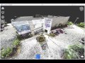 Laser Scanning for As-Built Drawings
 Rilievo 3D Palazzo Storico con Leica BLK 360, Analist e OneRay-RT
 Leica ScanStation P40: How-to start a scan
 Scanning with the BLK360
 Laser Scanning & BIM or Scan-to-BIM
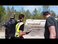 Leica Pegasus:Backpack for forestry and quarry applications
 3D scanning with Reality Capture -Merging Componants
 Introduction to Terrestrial Laser Scanning - TerraDat
 RTC360: What is VIS?
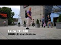 Leica RTC360 Double scan feature | Automatic noise filtering
 Photogrammetry vs. "Real" 3D Scanner
 Tech Highlight Demo: Leica RTC360