How to Clip Satellite Image in Global Mapper.
This video is about cropping satellite image in global mapper. Cropping Raster in global mapper.
Видео How to Clip Satellite Image in Global Mapper. канала GeoTech Expert
Видео How to Clip Satellite Image in Global Mapper. канала GeoTech Expert
Показать
Комментарии отсутствуют
Информация о видео
Другие видео канала
 Clip Raster Image in Global Mapper 19
 Download High Resolution Google Earth Image from SAS Planet II SAS Planet Tutorial
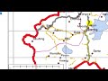 How to Digitalize in Global Mapper?
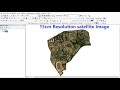 How to Download High Resolution Satellite Image from global mapper
 Cropping a raster file in Global Mapper
 Global Mapper: How to download satellite images in Global Mapper
 Mosaic Raster Layers in Global Mapper 18
 Georeferencing Satellite Image in Global Mapper
 Geo-reference/rectify a topomap in Global Mapper.
 Global Mapper in How to Create Map Layout & Adding Grid Coordinates
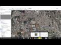 Download Very High Resolution Georeferenced Satellite Image
 How to Create Grid in Global Mapper
 Raster Processing in Global Mapper
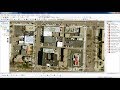 Download very high resolution satellite image 0.3 metre for free
 Using the Digitizer in Global Mapper
 Download High Resolution Satellite Image from Bing Maps for free
 How to Georeference a map in Global Mapper
 Rectify/Georeference google earth image using Global mapper
 Download High Resolution Satellite Images USGS 2017 (Updated)
 how to download Google Earth images very high resolution using Sasplanet