How to process RGB and multispectral drone imagery in Pix4D (Drones in agriculture series, 2/7)
0:00 Background and installation
1:36 RGB (true-color) image processing
8:00 RGB outputs
17:49 Multispectral imagery processing
22:04 Multispectral outputs
This tutorial covers how to create 3D models and a variety of 2D outputs based on typical drone-based imagery. This focuses on processing of RGB and multispectral drone imagery with Pix4dMapper. Thermal data can also be processed using the exact same methods as RGB imagery, except by choosing "Thermal camera" as the processing template rather than "3D map". The process of reconstructing models from images (photogrammetry) is the starting point of drone data processing in agriculture and plant sciences
Видео How to process RGB and multispectral drone imagery in Pix4D (Drones in agriculture series, 2/7) канала Travis Parker
Показать
Комментарии отсутствуют
Информация о видео
Другие видео канала
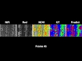 weedNet: Dense Semantic Weed Classification Using Multispectral Images and MAV for Smart Farming
 Drone Mapping with Pix4D Capture
 Processing Drone Images with GCPs using Pix4D Mapper
 Pix4D - Drone mapping for digital agriculture
 Webinar | Affordable high-end multispectral solution for agriculture: Agrowing and UgCS Mapper
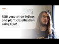 Calculating vegetation indices & plant/soil separation with QGIS (Drones in agriculture series, 3/7)
 WEBINAR: Use Multispectral Imaging to Boost Crop Health From Data Collection to Analysis
 Webinar: Mapping Extensive Areas with Thermal Drones
 DJI Phantom 4 Multispectral Overview
 Top Uses for Drones on the Farm in 2021
 Pix4D - Video Tutorial - Introduction to a Pix4Dmatic workflow
 Accurate georeferencing in Pix4D - Pix4Dmapper Video Tutorial 2
 Visualizing MicaSense data with QGIS
 Getting started with your first Pix4Dmapper project - Pix4Dmapper Video Tutorial 1
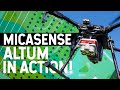 MICASENSE ALTUM IN ACTION! MultiSpectral Camera on a Drone!
 DroneCamp 2020: Introduction to Multispectral Image Processing with Pix4D Mapper
 Pix4D Tutorial 4: Using the rayCloud
 How to Process MicaSense Sensor Data in Pix4D
 Agisoft Metashape Tutorial - Full Processing from photos to dense cloud - with Ground Control Points
 Pix4D - Pix4Dfields trial plot operations