- Популярные видео
- Авто
- Видео-блоги
- ДТП, аварии
- Для маленьких
- Еда, напитки
- Животные
- Закон и право
- Знаменитости
- Игры
- Искусство
- Комедии
- Красота, мода
- Кулинария, рецепты
- Люди
- Мото
- Музыка
- Мультфильмы
- Наука, технологии
- Новости
- Образование
- Политика
- Праздники
- Приколы
- Природа
- Происшествия
- Путешествия
- Развлечения
- Ржач
- Семья
- Сериалы
- Спорт
- Стиль жизни
- ТВ передачи
- Танцы
- Технологии
- Товары
- Ужасы
- Фильмы
- Шоу-бизнес
- Юмор
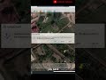
3D Reshaper Software Tutorial: Multi-Layer Ground Points Extraction
In this comprehensive tutorial series, we'll explore the process of extracting ground points from various point cloud datasets using the powerful 3D Reshaper software. As surveyors, GIS professionals, and geospatial analysts, the ability to accurately identify and extract ground features from complex point cloud data is crucial for a wide range of applications, including terrain modeling, infrastructure planning, and environmental monitoring.
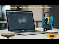
Learn the step-by-step methods to import your point cloud data into 3D Reshaper, leverage the software's advanced classification and segmentation tools to isolate the ground points, and seamlessly export the extracted ground features for further analysis and visualization. Discover best practices for handling different point cloud sources, optimizing the processing parameters, and integrating the ground point data into your broader geospatial workflows.
Whether you're new to 3D Reshaper or looking to enhance your existing point cloud processing skills, this channel will provide you with the knowledge and expertise to streamline your ground feature extraction processes. Subscribe now and unlock the full potential of 3D Reshaper for your geospatial projects!
3D RESHAPER INSTALLATION FILE
Download Link : https://3dreshaper1.software.informer.com/download/
Видео 3D Reshaper Software Tutorial: Multi-Layer Ground Points Extraction канала Nexxis Tutorials
Комментарии отсутствуют
Информация о видео
3 апреля 2023 г. 21:29:28
00:07:23
Другие видео канала