Georeferencing a scanned map and digitizing vectors in QGIS3
This video shows how to georeference a scanned map and to use it as a backdrop for digitizing points, lines and polygon vectors. The vector layers are stored in a GeoPackage, including their styles.
This video is part of IHE Delft OpenCourseWare. More free resources can be found at http://www.gisopencourseware.org
For an overview of our GIS courses and info on tailor made trainings and advise see our folder: https://www.un-ihe.org/sites/default/files/2019_qgis_certification_programme_0.pdf
More information about the book "QGIS for Hydrological Applications - Recipes for Catchment Hydrology and Water Management" by Kurt Menke and Hans van der Kwast can be found at the website of Locate Press: http://www.locatepress.com/hyd
IHE Delft and Nieuwland Geoinformatie offer an online course. It includes support from experienced trainers and you'll get the official QGIS certificate after completion. More info at: http://www.learning-gis.com
Subscribe to the YouTube Channel for updates!
Видео Georeferencing a scanned map and digitizing vectors in QGIS3 канала Hans van der Kwast
Показать
Комментарии отсутствуют
Информация о видео
Другие видео канала
 QGISHydro Webinar 1: Georeferencing and digitizing vectors
 How to Georeference a Map (PDF/JPEG) in QGIS
 How to digitize automatic a scanned topographic map with ArcGIS
 Adding Photos to points in QGIS # Lesson 22 of 29 # QGIS Tutorial.
 Automatic raster to vector conversion in ArcGIS - part1
 An Absolute Beginner's Guide to QGIS 3
 Stream & Catchment Delineation with WhiteboxTools in QGIS
 Georeferencing in ArcGIS & How to convert georeferenced image into KML
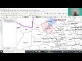 POLYGON DIGITIZATION USING SNAPPING OPTION IN QGIS
 Create Fishnet | Centroid with Grid in QGIS, 100 % Working Method
 QGISHydro Webinar 3: Spatial Analysis using Map Algebra
 QGIS 101: Georeferencing maps using satellite images
 Digitizing a Topomap in Arcmap || ArcGIS || Survey of India Topomap || SPATIAL TUBE
 How to Georeference Scanned Map using Grid Points in QGIS
 Landsat 8 Image Classification using QGIS
 Deriving River Network & Catchments from a DEM using QGIS
 QGIS Digitizing polygons
 Automatic Map Digitization || WMS Drainage layer to Shapefile Convert
 QGISHydro Webinar 7: Map Design