Galapagos Tour Fly-by
Straddling the equator approximately 1000 kilometers to the west of the South American mainland, the Galapagos Islands lie within the heart of the equatorial current system. Rising from the sea floor, the volcanic islands of the Galapagos are set on top of a large submarine platform. The main portion of the Galapagos platform is relatively flat and less than 1000 meters in depth. The steepest slopes are found along the western and southern flanks of the platform with a gradual slope towards the east. The interactions of the Galapagos and the oceanic currents create vastly different environmental regimes which not only isolates one part of the Archipelago from the other but allows penguins to live along the equator on the western part of the Archipelago and tropical corals around the islands to the north. The islands are relatively new in geologic terms with the youngest islands in the west still exhibiting periodic eruptions from their massive volcanic craters.
Data sets used in the Animation:
MODIS True Color
Landsat 30 Meter True Color
ETOPO 2 Bathymetry
MODIS Sea Surface Temperature
SeaWiFS Ocean Chlorophyll and Land Vegetation Index
SRTM Topography for Land Elevation
Видео Galapagos Tour Fly-by канала NASAEarthObservatory
Data sets used in the Animation:
MODIS True Color
Landsat 30 Meter True Color
ETOPO 2 Bathymetry
MODIS Sea Surface Temperature
SeaWiFS Ocean Chlorophyll and Land Vegetation Index
SRTM Topography for Land Elevation
Видео Galapagos Tour Fly-by канала NASAEarthObservatory
Показать
Комментарии отсутствуют
Информация о видео
Другие видео канала
 Earth Science Week 2011: Web resources overview
 Water vapor over Africa and the Atlantic Ocean
 Shuttle Discovery and ISS go from night to day, with aurora
 Global Temperatures 1880-2011
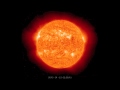 Side View of M8.7 Solar Flare from STEREO-A
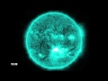 X1.4 Solar Flare at 131 Angstroms
 Migration Mystery: Robin Song
 X1.4 Solar Flare at 171 Angstroms
 Majestic Planet
 Tour Guide Andres Vergara at the Galapagos Islands
 Oceans Melting Greenland (OMG) Field Campaign: Vlog #3
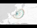 2011 Japan Tsunami Wave Height, the First 2.4 Hours
 Tournament Earth 2021: Astronaut Photography
 Pelicans at the Market
 Landsat Goes Over The Top: A Long View of the Arctic
 Tracking Deluge and Drought through Soil Moisture: Part 1
 Water Storage Maps Show Improvement
 Wild Weather off Alaska
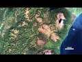 Kamchatka: The Erupting Peninsula
 Cyclone Causes Soggy Weather East of the Mississippi