Google Earth Engine #14: Trabajo con colección de imágenes; Sentinel e Landsat
Curso:
Google Earth Engine
Teledetección y Procesamiento Digital de Imágenes en nube
Nivel: Básico
#14: Trabajo con colección de imágenes; Sentinel e Landsat
LINKS
Sentinel
https://code.earthengine.google.com/ed5e3600d9f81a44bd952f6e31267f47
Landsat
https://code.earthengine.google.com/f538489c7b868836f9d0d80655b9d619
Видео Google Earth Engine #14: Trabajo con colección de imágenes; Sentinel e Landsat канала Efrain Yury SIGYURY .Turpo Cayo
Показать
Комментарии отсутствуют
Информация о видео
19 февраля 2018 г. 3:08:34
00:25:10
Другие видео канала
 Descarga de imágenes satelitales Sentinel / Landsat con corrección atmosférica
 Índice de Erosividad de la lluvia con ArcGIS
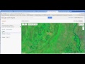 Google Earth Engine Parte 1
 Google Earth Engine #9: Introducción a Code Editor API presentación
 🌎 Google Earth Engine Curso⚙️¿Que es? Cómo Funciona? Español »INTRODUCCIÓN #01
 Landsat NDVI time-series in Google Earth Engine
 Clasificación Supervisada - RandomForest - Google Earth Engine - Landsat 8
 Google Earth Engine #11: Visualización de imágenes en Code Editor
 Google Earth Engine #12: Matemática de bandas, cálculo de NDVI
![QGIS tutorial: Google Earth Engine plugin [EN]](https://i.ytimg.com/vi/RNbzhlMHekU/default.jpg) QGIS tutorial: Google Earth Engine plugin [EN]
QGIS tutorial: Google Earth Engine plugin [EN] IMÁGENES LANDSAT 8 - Descarga y procesamiento en ArcMAP
 Temperatura de la superficie terrestre con ArcGIS
 Google Earth Engine Tutorial: Charting Forest Cover Loss By Year - Hansen-GFC 2000-2019
 Obtener curvas de nivel con Google Earth
 Índices de Vegetación - NDVI - SAVI - NDWI - en GOOGLE EARTH ENGINE
 How to Install and Use Google Earth Engine in Local Python Environment and Notebook
 Descarga de una imagen Satelital con Google Earth Engine
 Remote sensing with Python in Jupyter | burdGIS
 Curso Imágenes Satelitales Parte II Índice de vegetación de diferencia normalizada Landsat 8
 Webinar - Google Earth Vs. Google Earth Engine para tomar decisiones ambientales