Descarga de imágenes satelitales Sentinel / Landsat con corrección atmosférica
🚨Información Adicional: https://cutt.ly/VmuBTNM
🚨 https://ko-fi.com/alfonsoarteaga🚨https://paypal.me/LGAlfonsoArteaga 🚨r 🙂 sólo te costará 8 dólares.
Hilo de combinaciones de bandas satelitales https://twitter.com/SIGgeek/status/1265305544216240130
Instagram: https://www.instagram.com/gis_geek/
Descarga de imágenes Copernicus ESA Sentinel II A y B
https://scihub.copernicus.eu/dhus/#/home
Guía de Usuaria Sentinel https://sentinel.esa.int/web/sentinel/user-guides/sentinel-2-msi/processing-levels/level-2
Descarga de imágenes desde Landsat
https://earthexplorer.usgs.gov/
índice:
Un poco de teoría: Min. 1:56
Descarga Sentinel II: Min. 12:00
Descarga Landsat 8: Min. 25:04
Видео Descarga de imágenes satelitales Sentinel / Landsat con corrección atmosférica канала SIG Arteaga
Показать
Комментарии отсутствуют
Информация о видео
Другие видео канала

 Calculate NDVI from Sentinel 2 and reclassify in QGIS
 Tonga tsunami, quite impressive that it propagated all the way to stations in the coast of Méx.
 Crop phenology monitoring from harmonized Landsat 8 and Sentinel-2 green LAI time series
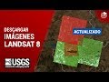 ¿Cómo descargar imágenes satelitales LANDSAT 8? | 2020
 Curso Illustrator - Capítulo 0, Introducción Para Principiantes
 Agisoft Metashape 1.6|Curvas de Nivel, Perfil del terreno + PAQUETE DE FOTOS
 IMÁGENES LANDSAT 8 - Descarga y procesamiento en ArcMAP
 Uso de Ventanas HTML en QGIS
 Curso básico qGis - Personalización de la interface, modo obscuro, SRC del proyecto.
 (04) Curso de procesamiento de imágenes Sentinel con SNAP –Funciones avanzadas de SNAP–
 Descarga de imágenes Sentinel 2 y cálculo de NDVI
 Diferencias entre #Sentinel 2 y #LANDSAT 8| funcionalidad de las bandas satelitales🛰️🌎
 Procesamiento de Imágenes Satelitales con ArcGIS 10.6
 How to process data from Sentinel-5P and get it to the geomatica
 🟣🌐🟣 Cómo realizar CORRECCIÓN ATMOSFÉRICA de Imágenes LANDSAT 8 en ArcGIS / Radiancia / Reflectancia
 Descarga de Imágenes Sentinel 2 || 2020
 ¿Cómo Descargar DEM de 12.5 Metros?
 Geomatica - Atmospheric Correction
 Sentinel 2 preprocesssing with SNAP