Topographic Map Using AutoCAD Civil 3D
How to make a topographic map using AutoCAD Civil 3D, Presented by Leandro Perez and Greg Phattanichitcon. University at Buffalo, Civil Engineering Department. CIE 303 GIS, GPS and Geodesy, Fall 2013.
Видео Topographic Map Using AutoCAD Civil 3D канала Leandro Perez
Видео Topographic Map Using AutoCAD Civil 3D канала Leandro Perez
Показать
Комментарии отсутствуют
Информация о видео
Другие видео канала
 Importing GIS Data Into AutoCAD Civil 3D
 CIVIL 3D - Topographic map/Detailing - Complete
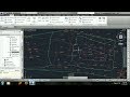 How to Import points, create contour lines with surface - AutoCAD Civil 3D
 Advanced Excel - Data Validation and Drop-Down Lists
 How to Create a Topo Map by using Excel and AutoCAD (English)
 INSERTING GOOGLE EARTH IMAGE TO AUTOCAD | MAKE SITE PLAN IN AUTOCAD USING GOOGLE EARTH
 How to import X Y coordinates from Excel to AutoCAD direct! (English)
 How to digitize automatic a scanned topographic map with ArcGIS
 How to Make a Concrete Sidewalk - Do It Yourself
 20 More Civil 3D Tips and Tricks in 20 Minutes!
 Basic Roadway Design in Civil 3D for Beginner
 How to make a contour map | Google Earth Pro | Autocad | Step By Step
 Autocad 2018 - How to draw a Location Site Plan
 Calculating Excavated Quantity using AutoCAD Civil 3D
 How to import x,y,z coordinate from Excel to AutoCAD
 Topographic Map Plotting in Autocad | Traversing And Contouring | Sw-DTM |
 30+ Civil 3D / AutoCAD Tips & Tricks in 30 Minutes!
 Road Design with Autodesk AutoCAD Civil 3D - Tutorial for Beginners
 Civil 3D Surface Creation
 Autocad Civil 3D Import points and Create contours / surface