calculate the volume of reservoir of DAM
On this video , I try to explain the technique to calculate the volume of a reservoir of a potential dam using Gloabal mapper and ArcGis software
Видео calculate the volume of reservoir of DAM канала algeria7002
Видео calculate the volume of reservoir of DAM канала algeria7002
Показать
Комментарии отсутствуют
Информация о видео
Другие видео канала
 How to calculate the volume of reservoir of Dam using ArcGIS
 Analyzing Terrain in Global Mapper
 Hydraulic Design Of Dams using WMS (In Arabic) (Part1: Sizing of dam height, width and capacity)
 Generate Contours using google earth & global mapper | Global Mapper | Google Earth | In Hindi |
 Creation of MNT and TIN from google earth, and conversion in arcgis
 Tut7: Calculate Pile Volume & Volumes Between Surfaces Using #Global_Mapper (subtitles CC: English)
 Calculating the Volume of a Raster using 3D Analyst of ArcGIS (ArcMap + ArcScene)
 How delineate watershed and classifying waterways according Strahler automatic on ArcGIS
 Top 10 Global Mapper Features
 Calculate Volume of Reservoir using ArcGIS
 Google Earth Engine: NDVI
 GeoTalks Express: What’s New in the Global Mapper Lidar Module v22.1
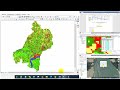 Accuracy Assessment | Kappa Coefficient | User Accuracy| Producer Accuracy| Overall Accuracy
 ArcGIS - Cut & Fill volumes Calculation in Earth Work - Easy Methods
 Gridding LiDAR to Create a DTM or DSM in Global Mapper
 Reservoir volume determination using GIS and Global mapper (GERD Reservoir)
 global mapper calculate volume between surface within specific area
 UTM to Lat Long | Easting Northing to Lat Long by Global Mapper
 accuracy assessment using arcgis 10.5 tutorial 6 | land use land cover map
 Flood Hazard Mapping in GIS-Flood Risk Mapping in ArcGIS