Todmorden Walk: Town Centre【4K】
Lying at one of the most westerly points in Yorkshire, around 3 miles away from the border to Lancashire, is the town of Todmorden.
The name Todmorden first appears in 1641 and is believed to mean 'Totta’s boundary-valley', probably in reference to the valley running northwest from the town. Geographically the town is located at the convergence of three steep-sided Pennine valleys, making it a popular destination for hikers and cyclists.
Before the Industrial Revolution, Todmorden was a small but prosperous woollen textile producing village using the streams from surrounding hills to fuel the mills. With the construction of the Rochdale Canal in 1804 and the main line of the Manchester and Leeds Railway in 1841, Todmorden became a key industrial town. A switch from wool to cotton brought about the construction of many grand Victorian mills in the area.
Despite a centuries-old rivalry between the counties of Yorkshire and Lancashire, stemming from the Wars of the Roses in the 15th century, Todmorden switched from Lancashire to West Yorkshire (or West Riding of Yorkshire as it was then known) in 1888. And yet it has a Rochdale dialling code and an Oldham postcode!
👇 SUBSCRIBE TO 4K EXPLORER FOR NEW VIDEOS EVERY WEEK 👇
https://www.youtube.com/4KExplorer?sub_confirmation=1
Filmed: 20th March 2021
Filmed on a Sony FDR-AX700 with a Zhiyun Crane 2 and a Rode Stereo VideoMic Pro.
TIMESTAMPS:
0:00 Burnley Road
3:29 Water Street
4:51 Rochdale Road
5:53 Rochdale Canal
7:16 Longfield Road
8:07 Bankside
8:24 Outside Todmorden Unitarian Church
9:02 Todmorden Unitarian Church
9:09 Outside Todmorden Unitarian Church
10:51 Todmorden panorama
Видео Todmorden Walk: Town Centre【4K】 канала 4K Explorer
Показать
Комментарии отсутствуют
Информация о видео
Другие видео канала
 Todmorden
 Driving Hebden Bridge to Littleborough via Todmorden and Walsden. HD Scenic DashCam.
 Kidderminster Walk: Town Centre【4K】
 Todmorden An Incredible Town
 Worcester Walk: City Centre【4K】
 CYCLING TO THE BOARDROOM CAFE - TODMORDEN
 Otley, West Yorkshire【4K】| Town Centre Walk 2021
 Todmorden from the air
 Dorking Walk: Town Centre【4K】
 23/Nov/2020. Walk: Todmorden - Walsden.
 Rochdale Walk: Town Centre【4K】
 TODMORDEN - PAST & PRESENT (and some surrounding areas)
 Newark on Trent Walk: Town Centre【4K】
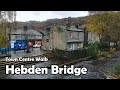 Hebden Bridge, West Yorkshire | Town Centre Walk 2020
 A Great walk up to Stoodley Pike | Todmorden | Calderdale
 Scunthorpe Walk: Town Centre【4K】
 Dorset Guided Walks: Swanage to Corfe Castle along the Purbeck Way
 Preston Walk: City Centre【4K】
 The Rochdale Way
 A RAILWAY JOURNEY FROM GUISBOROUGH TO WHITBY (TOWN)