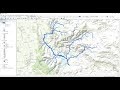
Arc Hydro Tools (Drainage Extraction) - ArcMap - Hydrologyl Study in ArcMap
This video illustrates how to extract drainage network using Digital Elevation Model(DEM) in ArcMap
Видео Arc Hydro Tools (Drainage Extraction) - ArcMap - Hydrologyl Study in ArcMap канала Geo-Spatial Tutorials
Видео Arc Hydro Tools (Drainage Extraction) - ArcMap - Hydrologyl Study in ArcMap канала Geo-Spatial Tutorials
Показать
Комментарии отсутствуют
Информация о видео
Другие видео канала
 Stream Order from a Digital Elevation Model (DEM) using ArcGIS
 HEC-GeoRAS y HEC-RAS
 ARCGIS : How to delineate watershed using ARC HYDRO?
 watershed delineation using Arc Hydro in Arcgis 10.5
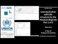 Learning Python with GIS: A Lecture for the Absolute Beginner: Part 1 of 5 ( ArcGIS Pro Python Tour)
 How to extract contour lines And DEM from Google Earth
 Stream Order Using ArcGIS (2019)
 Download and Install Arc Hydro tool in ArcGIS
 Catchment Area calculation By ArcGis 10.4. Watershed Calculation,Hydrology
 Drainage/Stream Density Distribution Map & Drainage density value of a basin using ARCGIS
 Adding Google Maps, Bing Maps, Open Street Maps, Oceanic Maps as Base Map in ArcGIS
 Watershed Delineation using Arc Hydro Tools
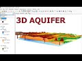 Three-Dimensional Visualization of Ground-water Model ArcGIS & ArcScene/Development of 3D Aquifer
 Catchment area using ArcGIS
 Red hídrica y orden de ríos con ArcGIS
 Deriving River Network & Catchments from a DEM using QGIS
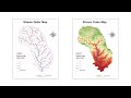 River Stream Order Map in ArcGIS | ArcGIS Tutorial 28
 ArcHydro ArcGis Extract des bassins versants et réseaux hydrographiques
 Mosaicking (Combine or Stitch) Images in ArcMap