DJI LIDAR Zenmuse L1, Phantom 4 RTK & DJI Terra (TESTED WITH PERTAMINA IN INDONESIA)
DISCLAIMER: The Zenmuse L1 shown in the video is a beta test unit provided by DJI, in commitment to seek user feedback from key enterprise users globally. Real results may vary from what is shown. Results displayed also include those generated by Phantom 4 RTK and DJI Terra post-processing of photogrammetry, in addition to other geospatial imaging solutions, including the Emesent Hovermap LIDAR & Autonomy payload used widely by Halo Robotics. Any opinion in this video is that of the author, and is not given or endorsed by DJI or Pertamina.
SPECIAL THANKS: Pertamina is Indonesia's largest company and a Global Fortune 500 active in the energy sector. Halo Robotics is grateful to work with Pertamina to support process optimization through commercial drones. It is an honor to share the the results of Zenmuse L1 beta test activities together with Pertamina Geothermal Energy (PGE), and Pertamina Upstream Technology Center (UTC), and we sincerely appreciate Pertamina's permission to share this rare footage with public audiences.
The Zenmuse L1 is a major breakthrough for the commercial drone industry, as an affordable high spec LIDAR sensor completely integrated into DJI’s flagship commercial drone, the M300. Working with Pertamina, Indonesia's energy giant, we had the opportunity to test the Zenmuse L1, together with a suite of DJI geospatial solutions, including the Phantom 4-RTK drone and DJI Terra post-processing software, which also generates point cloud data shown in this video.
LIDAR itself is a laser-based imaging system which until now has been too expensive for most companies to bring on internally. In aerial surveying, LIDAR plays a vital role as it is able to provide a 3D scan of areas or structures with an extraordinarily high level of accuracy. The laser scanner sends out laser pulses – hundreds of thousands of points per second – and each point has its own position in 3-dimensional space. The resulting “point cloud,” taken together, closely resembles a computerized model of the real-world objects and areas that were scanned, with a very high level of geospatial location accuracy for any given point.
The Zenmuse L1 integrates a powerful light-weight LIDAR module with a 70° FOV and high-accuracy IMU, together with a 20MP survey camera which has a 1-inch CMOS sensor and a mechanical shutter, on a 3-axis stabilized gimbal that plugs straightforwardly into the M300 drone. By overlaying the camera’s RGB color values on top of the laser points, the Zenmuse L1 can generate true-color point clouds. With a Point Rate of 240.000 points per second and a detection range of 460 meters, the ease and speed of capturing quality LIDAR data is unprecedented; using the DJI M300, it is possible to capture up to up to 2 km2 in a single flight.
This is a turning point for commercial drones, with prices that are approachable for the broadest possible market, for high end survey technology, to produce data which is very high value for companies and government organizations.
To learn more about commercial drone solutions and the DJI Zenmuse L1, please contact Halo Robotics:
Mobile/WhatsApp: +62 811 8549 888
enterprise@halo-robotics.com
www.halorobotics.co.id
Better Business Through Technology
Видео DJI LIDAR Zenmuse L1, Phantom 4 RTK & DJI Terra (TESTED WITH PERTAMINA IN INDONESIA) канала Halo Robotics
Показать
Комментарии отсутствуют
Информация о видео
Другие видео канала
 Don't buy the DJI Zenmuse L1 until you've seen this! ROCK vs RIEGL vs DJI
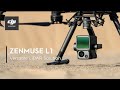 DJI Enterprise Zenmuse L1 - Versatile LiDAR Solution
 Workflows for Combining LiDar and Photogrammetry Data - 2021 Western Regional Survey Conference
 INTERGEO 2020 | DJI Unveils its Latest Surveying and Mapping Solution
 DJI Zenmuse L1 - In the Field
 Πτήση DJI AGRAS T30-Διανομή Λιπάσματος-Αποφυγή Εμποδίου (Καταγραφή μέσω RC) (2)
 New DJI Zenmuse L1 LiDAR - Real-Time 3D data Review
 I spent $180,000 on this LiDAR now DJI released one for $500
 LiDAR Drone Powerline Inspection | ROCK R2A | DJI M210
 DJI Matrice 300 RTK + L1 **FULL DEMO**
 DJI M300 with Zenmuse P1 Ohanavan Сanyon (DJI Terra)
 Industrial inspection drone: UAView Stereo
 DJI Zenmuse L1 - Back in the office
 Sow fertilizer using a DJI T30 drone
 City 3D model: Metashape + DJI Zenmuse P1.
 Πτήση DJI AGRAS T30-Διανομή Λιπάσματος-Αποφυγή Εμποδίου (Καταγραφή μέσω RC)
 Introducing Flyability Inspector 3.0 (BEST SOFTWARE FOR DRONE INSPECTIONS?)
 Processing DJI L1 Point Cloud with TerraScan UAV and TerraModeler UAV
 DJI + Trimble Better Together - Base stations, Phantom 4 RTK, + More
 Drones for General Visual Inspection (GVI) + REAL EXAMPLES with DJI M300 & H20T • BAHASA INDONESIA