How to find Antarctic crevasses | Polar Science
Researchers are using the technology to plan traverse routes through rift-laden territory.
Antarctic researchers and support staff can now more easily find and avoid dangerous crevasses on long traverses carrying supplies to remote camps and stations, thanks to the help of a German radar satellite.
An international team of scientists and engineers recently found that radar satellites can reliably detect crevasses in Antarctic ice even when they are hidden beneath feet of snow. They are now using the satellite data to map locations of crevasses along routes used for traverses, where fleets of tractors drive fuel and supplies over the ice for hundreds of miles to remote field camps and other parts of Antarctica.
The new tool helps make long, overland supply drives safer and faster, while also providing glaciologists with a new way to study the movements of ice sheets from afar, according to the authors of a recent study describing how to use the method.
To learn more, visit https://antarcticsun.usap.gov/science/4454/
Видео How to find Antarctic crevasses | Polar Science канала National Science Foundation News
Показать
Комментарии отсутствуют
Информация о видео
21 мая 2022 г. 20:00:25
00:02:51
Другие видео канала
 Harnessing Architected Materials 🏫 | Science Nation
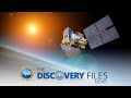 Uncovering the Mystery of Cosmic Rays #spaceweather
 Muon g-2 - Moving the worl'd largest electromagnetic ring
 Chemists work up new formulas for greener plastic - Science Nation
 Searching for Answers | Mysteries of the Brain
 Origins REVEALED! Chincoteague ponies #horses
 Giving robots and prostheses the human touch - Science Nation
 Flying Communications for First Responders 🔥👩🚒👨🏾🚒 | Science Nation
 Nature-inspired, Greener Architecture 🏦🌳 | Science Nation
 Soft robot arm inspired by octopus attaches, wraps around, carries, and releases
 Strange, surprising and Star-nosed
 Universe Expansion #shorts
 What are one-birth volcanoes? 🌋#volcanoes
 Meet an Atmospheric Scientist
 When Nature Strikes - Flash Floods
![[LIVE] Iceless Antarctica | McMurdo Dry Valleys {Session 1}](https://i.ytimg.com/vi/Hoy3yvlpLTg/default.jpg) [LIVE] Iceless Antarctica | McMurdo Dry Valleys {Session 1}
[LIVE] Iceless Antarctica | McMurdo Dry Valleys {Session 1} Mysteries of Mayan Civilization | Podcast
![NSF Convergence Accelerator [Research Funding]](https://i.ytimg.com/vi/3XK1icNpevI/default.jpg) NSF Convergence Accelerator [Research Funding]
NSF Convergence Accelerator [Research Funding] Don't wastewater--let the sun recycle it!
 Why is working memory so important to learning? | Ask a Scientist