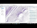
Labeling contour lines in ArcGIS
Contour lines are often represented by many individual line features, which can result in many more labels being placed than necessary. To avoid this problem, line features that represent contours can be treated as special types of line features. The Maplex Label Engine groups the segments of contour features, if the symbology and label match and the features are connected, and treats them as single, long features. This allows labels to be placed for the contour as a whole rather than for each segment. Contour labels can be aligned in ladders where the label will appear to step up and step down the contours in a straight (or curved) path. These ladders can be created with labels from multiple label classes. The contour labels can be aligned to the page, ensuring that the label is never placed upside down, and also aligned to the contour elevations so that the top of the label is always facing uphill.
How to Set My Business Address, Shop, Location, on Google Maps
https://www.youtube.com/watch?v=NjAIipt3usw
Видео Labeling contour lines in ArcGIS канала Géo Tech
How to Set My Business Address, Shop, Location, on Google Maps
https://www.youtube.com/watch?v=NjAIipt3usw
Видео Labeling contour lines in ArcGIS канала Géo Tech
Показать
Комментарии отсутствуют
Информация о видео
Другие видео канала
 Module 5: How to Generate Contours in ArcGIS for Desktop
 ArcGIS Tutorial - Create DEM and Contours using Google Earth
 How to convert scanned image to shapefile in Arcgis
 QGIS Contours and Contour Labels
 Tips for Labeling Point in ArcMap
 Download very high resolution satellite image 0.3 metre for free
 CREATE CROSS SECTION IN ARCGIS
 Create contour map via ArcGIS
 Creating a Contour Map from a Digital Elevation Model in ArcGIS
 CREATE SLOPE MAP FROM DEM IN ARCGIS
 How to digitize automatic a scanned topographic map with ArcGIS
 ArcGIS tutorial #1 :Study area map in Nepali
 How to extract contour lines And DEM from Google Earth
 SW-DTM: How To Draw Contour Lines in AutoCAD Part_1
 Change Contour Label Text Height
 creating a flow maps with ArcGIS
 Generate contour lines from raster DEM terrain grid in Global Mapper
 how to visualize aquifer surfaces using ArcGis/ArcScene
 Adding Google Map in ArcGIS as Portable Basemap Server PBS
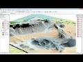 ArcGis 3d analyst Draping an image over a terrain surface