- Популярные видео
- Авто
- Видео-блоги
- ДТП, аварии
- Для маленьких
- Еда, напитки
- Животные
- Закон и право
- Знаменитости
- Игры
- Искусство
- Комедии
- Красота, мода
- Кулинария, рецепты
- Люди
- Мото
- Музыка
- Мультфильмы
- Наука, технологии
- Новости
- Образование
- Политика
- Праздники
- Приколы
- Природа
- Происшествия
- Путешествия
- Развлечения
- Ржач
- Семья
- Сериалы
- Спорт
- Стиль жизни
- ТВ передачи
- Танцы
- Технологии
- Товары
- Ужасы
- Фильмы
- Шоу-бизнес
- Юмор
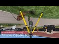
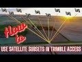
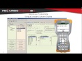
How to Connect a Juniper Geode GNSS Receiver to ArcGIS Field Maps (iPhone/iPad Setup Guide)
In this tutorial, we walk through the complete process of connecting a Juniper Geode GNSS receiver to ArcGIS Field Maps on an iOS device. Whether you're collecting utility assets, infrastructure data, environmental observations, or GIS field data, this workflow will help you achieve higher positional accuracy than your device's internal GPS.
In this video you'll learn how to:
• Power on the Juniper Geode receiver
• Pair the Geode with your mobile device via Bluetooth
• Verify receiver status and satellite tracking in Geode Connect
• Configure location and correction settings
• Connect ArcGIS Field Maps to the Geode receiver
• Confirm Field Maps is using the external GNSS receiver
• Validate accuracy and positioning before collecting data
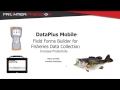
The Juniper Geode provides an affordable, easy-to-use GNSS solution for GIS professionals who need reliable, high-accuracy positioning in the field. Combined with ArcGIS Field Maps, it creates a powerful workflow for asset management, inspections, mapping, and field data collection.
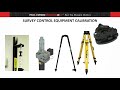
Equipment & Software:
• Juniper Geode GNSS Receiver
• Geode Connect App
• ArcGIS Field Maps
• ArcGIS Online / ArcGIS Enterprise
• iPhone / iPad
Видео How to Connect a Juniper Geode GNSS Receiver to ArcGIS Field Maps (iPhone/iPad Setup Guide) канала Frontier Precision
In this video you'll learn how to:
• Power on the Juniper Geode receiver
• Pair the Geode with your mobile device via Bluetooth
• Verify receiver status and satellite tracking in Geode Connect
• Configure location and correction settings
• Connect ArcGIS Field Maps to the Geode receiver
• Confirm Field Maps is using the external GNSS receiver
• Validate accuracy and positioning before collecting data
The Juniper Geode provides an affordable, easy-to-use GNSS solution for GIS professionals who need reliable, high-accuracy positioning in the field. Combined with ArcGIS Field Maps, it creates a powerful workflow for asset management, inspections, mapping, and field data collection.
Equipment & Software:
• Juniper Geode GNSS Receiver
• Geode Connect App
• ArcGIS Field Maps
• ArcGIS Online / ArcGIS Enterprise
• iPhone / iPad
Видео How to Connect a Juniper Geode GNSS Receiver to ArcGIS Field Maps (iPhone/iPad Setup Guide) канала Frontier Precision
Комментарии отсутствуют
Информация о видео
16 июня 2026 г. 18:52:14
00:05:57
Другие видео канала