- Популярные видео
- Авто
- Видео-блоги
- ДТП, аварии
- Для маленьких
- Еда, напитки
- Животные
- Закон и право
- Знаменитости
- Игры
- Искусство
- Комедии
- Красота, мода
- Кулинария, рецепты
- Люди
- Мото
- Музыка
- Мультфильмы
- Наука, технологии
- Новости
- Образование
- Политика
- Праздники
- Приколы
- Природа
- Происшествия
- Путешествия
- Развлечения
- Ржач
- Семья
- Сериалы
- Спорт
- Стиль жизни
- ТВ передачи
- Танцы
- Технологии
- Товары
- Ужасы
- Фильмы
- Шоу-бизнес
- Юмор
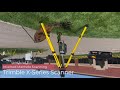
Bridging the Gap Between Geospatial Survey and UAS - Technology Webinar - Part 1
A Collaborative Approach of Analyzing UAS Photogrammetry vs LiDAR Data
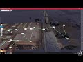
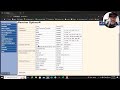
This webinar is Session 1 of a two-part series to be continued in January 2024. In this presentation, we focus on the UAS and Geospatial Survey hardware and software platform used on this unique “proof of concept” project. We take a “deep dive” into survey ground control data collection, processing, and statistical reporting.
The session closed with an introduction to the recently released ASPRS Edition 2 Standards and CAD deliverables that will be formalized in Session 2, January 2024.
Frontier Precision - How You Measure Matters.
https://frontierprecision.com/
#frontierprecision #howyoumeasurematters
Видео Bridging the Gap Between Geospatial Survey and UAS - Technology Webinar - Part 1 канала Frontier Precision
Комментарии отсутствуют
Информация о видео
8 декабря 2023 г. 19:57:25
00:58:43
Другие видео канала