QGIS 101: How to import Excel Data (No CSV files)
In this video I will show you how to prepare a properly formatted Excel file which you can drop into QGIS to make a map of point data. We will use some water well data from the Kharga Oasis in the Western Desert of Egypt, where I used to work. You will learn:
- tips and tricks of 'copy-paste'
- how to prepare a single title row
- Format the data as and Excel table & how to rename the table in Name Manager
- the importance of keeping data clean; don't mix numbers with text
We will import this data into QGIS without going via a CSV file & then you will learn:
- creating a points layer from table
- Editing point symbols & colours
- Adding labels and adjusting text buffer & placement
- Editing labels using the Expression Dialog
- Exporting point layer to GeoPackage
- Copying styles between layers
- Saving styles in GeoPackage
Source of data: Mustafa El-Rawy and Florimond De Smedt (2020): Estimation and Mapping of the Transmissivity of the Nubian Sandstone Aquifer in the Kharga Oasis, Egypt; Water 2020, 12, 604; doi:10.3390/w12020604
Link to paper: https://bit.ly/2FWEFXf
Link to processed Excel sheet: https://bit.ly/2TtDh1j
For more videos on QGIS, see the QGIS 101 Playlist: https://youtube.com/playlist?list=PLp1lK6n-xb5Pqm6JmiwORjm8vuK5g2yf1
Видео QGIS 101: How to import Excel Data (No CSV files) канала Geosearch International
Показать
Комментарии отсутствуют
Информация о видео
25 октября 2020 г. 2:35:49
00:10:47
Другие видео канала
 How to Add Excel file CSV with Shape file in QGIS 2021 ENGLISH
 An Absolute Beginner's Guide to QGIS 3
 Adding Geotagged Photos in QGIS # Lesson 29 of 29 # QGIS Tutorial.
 Importing CSV (Excel) Coordinates into QGIS
 Importing Excel file (CSV) Coordinates in QGIS (ENGLISH)
 Climate Engine: Download FREE Daily CHIRPS precipitation data over a catchment (drainage basin)
 QGIS Layer Properties: Symbology and Labels
 Editing Attribute Table in QGIS
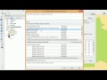 Excel or CSV to QGIS | burdGIS
 Add points from a CSV file to QGIS 3 (the right way)
 QGIS 3 for Absolute Beginners
 How to convert XY Coordinate Excel data into Point, Line and Polygon shapefiles using QGIS
 QGIS Export Attribute Table to Excel and CSV
 QGIS User 0024 - GeoPackage
 Use QGIS to merge a csv file to a shp file tutorial
 Creating and designing a dashboard with ArcGIS
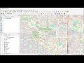 Extracting Data from OpenStreetMap using QGIS & QuickOSM
 QGIS - Importing spatial data from spreadsheets (CSV files)
 Prepare Study Area Map Easily |QGIS
 Change the properties of an attribute field in QGIS