2010 Pacific Typhoon Season Animation V2
The 2010 Western Pacific Typhoon Season was the least active typhoon season on record. A transition from a strong El Nino in 2009 to a strong La Nina began in the Equatorial Pacific making conditions extremely unfavourable for Tropical Cyclone development in the Western Pacific. Only 28 depressions formed which if all of them became tropical storms it would be about an average season but only 14 did. 7 intensified into typhoons and just one reached super typhoon strength.
The season started in March with Omasis which became a tropical storm while staying mainly out to sea east of The Philippines. After this it was another 4 months before a storm formed when in July 2 typhoons formed, Conson (Basyang) and Chanthu (Caloy) as both of these storms impacted The Philippines and Hong Kong causing heavy flooding. This was followed by August which was the most active month as 5 storms formed. Domeng was named a Tropical Storm by PAGSA but was not officially called one by the JMA leading to it not being official. But Diamnu (Ester) quickly took its place as it moved north and caused heavy flooding over China, Japan, and South Korea causing heavy damage with a heavy loss of life. Then starting on August 21 and going into September 1, 6 storms formed in quick succession. Notably, Minduelle brought heavy rains to Vietnam and Kompasu (Glendale) becoming the strongest storm to hit South Korea in 15 years killing 29 as it hit Seoul directly. September featured only 4 storms with 3 of them becoming typhoons. During this month, Malou (Henry) brought heavy rains to Japan, which relieved one of the worst heat waves in the country's history. But the main feature this month was Fanapi (Inday) which made landfall in Taiwan as a Category 3 hurricane causing heavy flooding killing 103 people and doing heavy damage. But all these storms were blown away by the second to last storm of the year which formed almost a month later on October 12. It formed over the Philippine Sea where there was plenty of energy to fuel it because of a lack of storms in that region. It received the name Megi (Juan) on October 13 and began to steadily intensify from there. On October 16 the storm began to suddenly rapidly intensify going from a Category 2 on that day to a Category 5 on September 17. Even with this, the storm was not done yet and it continued to intensify until its winds hit 296kph (186mph) and a pressure of 885mb becoming the 11th strongest storm on record in the Western Pacific basin history and the strongest in over 25 years. It maintained this intensity all the way up until its landfall on Luzon Island where it brought catastrophic impacts killing 69 people. It significantly weakened after crossing the island dropping back to a Category 1 but it restrengthened to a Category 4 shortly thereafter as it made a sharp turn to the north. After that, it began to gradually weaken as it slowly moved north and made landfall in China as a Category 1 hurricane. After this, Category 4 Hurricane Chaba (Katring) became a final storm of the season as it skimmed the coast of Japan as a Tropical Storm.
Support us by using all of our outlets below! ↓
Become a Channel Member ► https://www.youtube.com/forcethirteen/join
Become a Patron ► https://www.patreon.com/forcethirteen
View our Merchandise Store ► https://teespring.com/stores/force-thirteen
Join our Discord Server ► https://discord.gg/forcethirteen
Follow us on Facebook ► https://www.facebook.com/ForceThirteen/
Follow us on Twitter ► https://twitter.com/ForceThirteen
Subscribe to Force Thirteen ► https://www.youtube.com/c/Forcethirteen?sub_confirmation=1
Видео 2010 Pacific Typhoon Season Animation V2 канала Force Thirteen
Показать
Комментарии отсутствуют
Информация о видео
Другие видео канала
 2020 Pacific Typhoon Season Animation
 2015 Pacific Typhoon Season Animation v.2
 1964 Pacific Typhoon Season Animation
 Tropical Storm Elsa approaches Cuba & Jamaica - Live Hurricane Tracker
 1990 Pacific Typhoon Season Animation
 2005 Atlantic Hurricane Season Animation V.5
 2020 Atlantic Hurricane Season Animation
 Top 10 Strangest Hurricanes of All Time
 2007 Pacific Typhoon Season Animation
 Top 10 Hurricanes of All Time
 2013 Pacific Typhoon Season Animation v.2
 1973 Pacific Typhoon Season Animation
 Force Thirteen's Hurricane Week 2015 Part 1/6
 Top 10 Typhoons of All Time
 1995 Atlantic Hurricane Season Animation v.3
 2016 Pacific Typhoon Season Animation
 2019 Pacific Typhoon Season Animation
 2006 Pacific Typhoon Season Animation v2
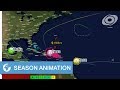 2017 Atlantic Hurricane Season Animation