- Популярные видео
- Авто
- Видео-блоги
- ДТП, аварии
- Для маленьких
- Еда, напитки
- Животные
- Закон и право
- Знаменитости
- Игры
- Искусство
- Комедии
- Красота, мода
- Кулинария, рецепты
- Люди
- Мото
- Музыка
- Мультфильмы
- Наука, технологии
- Новости
- Образование
- Политика
- Праздники
- Приколы
- Природа
- Происшествия
- Путешествия
- Развлечения
- Ржач
- Семья
- Сериалы
- Спорт
- Стиль жизни
- ТВ передачи
- Танцы
- Технологии
- Товары
- Ужасы
- Фильмы
- Шоу-бизнес
- Юмор
Web Mapping with GeoServer: Raster Upload and SLD Styling
LULC Course: https://www.udemy.com/course/google-earth-engine-supervised-classification-for-lulc/?referralCode=952B5F2605AB7C9EB282
Algae Bloom Analysis: https://www.udemy.com/course/google-earth-engine-algae-bloom-analysis-seasonal-changes/?referralCode=75255D0FA0FDAB489F7C
GIS Web Mapping: https://www.udemy.com/course/gis-web-mapping-with-react-leaflet-postgresql-and-postgis/?referralCode=94E14087067E7BE7C648
Install Geoserver: https://www.youtube.com/watch?v=DizbLWk0oq8
In this tutorial, you’ll learn how to upload, publish, and style raster data in GeoServer step by step.
If you’ve ever struggled with getting your raster layers to display correctly or look visually appealing, this video will guide you through the full workflow — from exporting your raster data to GeoServer, applying SLD styling, and previewing your final result.
🚀 What you’ll learn:
How to upload raster data to GeoServer
Publishing raster layers correctly
Applying SLD styles for better visualization
Previewing your raster layers in GeoServer
Best practices for raster web mapping
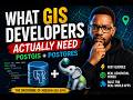
This tutorial is perfect for GIS developers, students, and anyone working with GeoServer, QGIS, Leaflet, or OpenLayers.
💡 Whether you're working with satellite imagery, elevation data, or analysis outputs, proper styling makes your maps more powerful and easier to understand.
Видео Web Mapping with GeoServer: Raster Upload and SLD Styling канала GIS Developer
Algae Bloom Analysis: https://www.udemy.com/course/google-earth-engine-algae-bloom-analysis-seasonal-changes/?referralCode=75255D0FA0FDAB489F7C
GIS Web Mapping: https://www.udemy.com/course/gis-web-mapping-with-react-leaflet-postgresql-and-postgis/?referralCode=94E14087067E7BE7C648
Install Geoserver: https://www.youtube.com/watch?v=DizbLWk0oq8
In this tutorial, you’ll learn how to upload, publish, and style raster data in GeoServer step by step.
If you’ve ever struggled with getting your raster layers to display correctly or look visually appealing, this video will guide you through the full workflow — from exporting your raster data to GeoServer, applying SLD styling, and previewing your final result.
🚀 What you’ll learn:
How to upload raster data to GeoServer
Publishing raster layers correctly
Applying SLD styles for better visualization
Previewing your raster layers in GeoServer
Best practices for raster web mapping
This tutorial is perfect for GIS developers, students, and anyone working with GeoServer, QGIS, Leaflet, or OpenLayers.
💡 Whether you're working with satellite imagery, elevation data, or analysis outputs, proper styling makes your maps more powerful and easier to understand.
Видео Web Mapping with GeoServer: Raster Upload and SLD Styling канала GIS Developer
geoserver raster tutorial geoserver upload raster geoserver publish raster geoserver styling raster sld geoserver tutorial raster styling geoserver web mapping geoserver gis tutorial geoserver geoserver beginner tutorial how to add raster geoserver geoserver raster layer tutorial qgis to geoserver raster geoserver preview layer gis web mapping tutorial leaflet geoserver raster openlayers geoserver raster geospatial development raster symbology geoserver
Комментарии отсутствуют
Информация о видео
10 апреля 2026 г. 10:00:30
00:17:43
Другие видео канала