- Популярные видео
- Авто
- Видео-блоги
- ДТП, аварии
- Для маленьких
- Еда, напитки
- Животные
- Закон и право
- Знаменитости
- Игры
- Искусство
- Комедии
- Красота, мода
- Кулинария, рецепты
- Люди
- Мото
- Музыка
- Мультфильмы
- Наука, технологии
- Новости
- Образование
- Политика
- Праздники
- Приколы
- Природа
- Происшествия
- Путешествия
- Развлечения
- Ржач
- Семья
- Сериалы
- Спорт
- Стиль жизни
- ТВ передачи
- Танцы
- Технологии
- Товары
- Ужасы
- Фильмы
- Шоу-бизнес
- Юмор
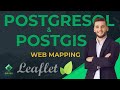
QGIS + PostgreSQL Tutorial | Connect Database & Load Spatial Data Easily
Postgres Course: https://www.udemy.com/course/gis-web-mapping-with-react-leaflet-postgresql-and-postgis/?referralCode=94E14087067E7BE7C648
In this tutorial, I show you how to connect PostgreSQL to QGIS and load spatial data step-by-step.
If you're working with spatial databases, PostGIS, or enterprise GIS workflows, this guide will help you connect your database, manage spatial tables, and visualize your data inside QGIS efficiently.
🚀 In this video, you will learn:
a) How to configure a PostgreSQL database
b) How to enable PostGIS extension
c) How to connect PostgreSQL to QGIS
d) How to load spatial tables
e) How to add and manage GIS data inside QGIS
This workflow is essential for:
GIS Developers, Spatial Data Analysts, Web GIS Engineers, Remote Sensing Professionals, Anyone working with enterprise GIS systems
PostgreSQL + PostGIS + QGIS is one of the most powerful open-source GIS stacks available today.
If you enjoy Geospatial Development, Web Mapping, PostGIS, QGIS, Leaflet, Python, and GIS automation — subscribe to GIS Developer for more advanced tutorials.
#QGIS #PostgreSQL #PostGIS #GIS #Geospatial #SpatialDatabase #OpenSourceGIS
Видео QGIS + PostgreSQL Tutorial | Connect Database & Load Spatial Data Easily канала GIS Developer
QGIS PostgreSQL PostGIS connect PostgreSQL to QGIS QGIS PostgreSQL tutorial PostGIS tutorial QGIS database connection spatial database tutorial GIS database QGIS PostGIS connection open source GIS GIS development enterprise GIS QGIS beginner tutorial PostgreSQL GIS spatial data management load PostGIS in QGIS QGIS database setup geospatial development GIS DEV
Комментарии отсутствуют
Информация о видео
24 февраля 2026 г. 2:00:32
00:06:12
Другие видео канала