- Популярные видео
- Авто
- Видео-блоги
- ДТП, аварии
- Для маленьких
- Еда, напитки
- Животные
- Закон и право
- Знаменитости
- Игры
- Искусство
- Комедии
- Красота, мода
- Кулинария, рецепты
- Люди
- Мото
- Музыка
- Мультфильмы
- Наука, технологии
- Новости
- Образование
- Политика
- Праздники
- Приколы
- Природа
- Происшествия
- Путешествия
- Развлечения
- Ржач
- Семья
- Сериалы
- Спорт
- Стиль жизни
- ТВ передачи
- Танцы
- Технологии
- Товары
- Ужасы
- Фильмы
- Шоу-бизнес
- Юмор
iPhone LiDAR with RTK: Unveiling Pix4Dcatch AR and Emlid Reach RX Integration
🔗 Products Featured in This Video:
Pix4Dcatch (FREE) - https://www.pix4d.com/product/pix4dcatch/
Emlid Reach RX GNSS Receiver ($1999) - https://store.emlid.com/rami
📢 Join the Surveying Community: https://thesurveyschool.com/
Visit The Survey School for resources to elevate your surveying career. Join our waitlist to access courses, premium content, and a supportive community of professionals.
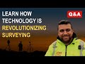
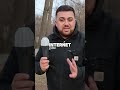
Check out the latest update from Pix4Dcatch and its integration with the Emlid Reach RX GNSS receiver! In this video, Rami explores the cutting-edge features of Pix4Dcatch AR, showcasing the new augmented reality functionalities that bring digital assets into the real world. Discover how the sleek handle design for the RX seamlessly integrates with your iPhone, transforming your device into a powerful mapping tool.
Witness a real-time demonstration of surveying a newly constructed site, comparing drone-captured data from earlier this year with the latest data collected using the updated Pix4Dcatch app and Emlid Reach RX for RTK corrections. See how the new construction is added to the master dataset on Pix4D Cloud, providing an accurate and comprehensive view of the site.
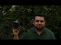
Learn how to utilize augmented reality to visualize utility plans directly in the field, making it easier to identify and locate underground utilities with precision. Watch as Rami walks through the site, showcasing the power of combining CAD drawings with AR for an immersive and informative experience.
Don't miss out on the benefits of this integration for construction updates, utility mapping, and more. Check out the links in the description to explore the products featured in this video and enhance your surveying capabilities.
👤 Meet the Surveyor:
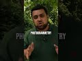
Hi there! My name is Rami Tamimi and I am a passionate surveyor and geodetic engineer. With over 10 years of experience in the land development industry, I have a wealth of knowledge to share. That's why I started my own YouTube channel, where I educate others about the surveying and geospatial industry and showcase exciting new technologies. Follow along as I share my expertise and keep up with the latest innovations in my field.
#Surveying #AugmentedReality #constructiontechnology
Be sure to like, comment, and subscribe for more tech updates and tutorials! Become a Survey Member for behind the scenes videos and content starting at just $4.99 - https://www.youtube.com/channel/UC5eVO8WbTV3FU3-AbtRnl9g/join
Видео iPhone LiDAR with RTK: Unveiling Pix4Dcatch AR and Emlid Reach RX Integration канала Rami Tamimi, P.S.
Pix4Dcatch (FREE) - https://www.pix4d.com/product/pix4dcatch/
Emlid Reach RX GNSS Receiver ($1999) - https://store.emlid.com/rami
📢 Join the Surveying Community: https://thesurveyschool.com/
Visit The Survey School for resources to elevate your surveying career. Join our waitlist to access courses, premium content, and a supportive community of professionals.
Check out the latest update from Pix4Dcatch and its integration with the Emlid Reach RX GNSS receiver! In this video, Rami explores the cutting-edge features of Pix4Dcatch AR, showcasing the new augmented reality functionalities that bring digital assets into the real world. Discover how the sleek handle design for the RX seamlessly integrates with your iPhone, transforming your device into a powerful mapping tool.
Witness a real-time demonstration of surveying a newly constructed site, comparing drone-captured data from earlier this year with the latest data collected using the updated Pix4Dcatch app and Emlid Reach RX for RTK corrections. See how the new construction is added to the master dataset on Pix4D Cloud, providing an accurate and comprehensive view of the site.
Learn how to utilize augmented reality to visualize utility plans directly in the field, making it easier to identify and locate underground utilities with precision. Watch as Rami walks through the site, showcasing the power of combining CAD drawings with AR for an immersive and informative experience.
Don't miss out on the benefits of this integration for construction updates, utility mapping, and more. Check out the links in the description to explore the products featured in this video and enhance your surveying capabilities.
👤 Meet the Surveyor:
Hi there! My name is Rami Tamimi and I am a passionate surveyor and geodetic engineer. With over 10 years of experience in the land development industry, I have a wealth of knowledge to share. That's why I started my own YouTube channel, where I educate others about the surveying and geospatial industry and showcase exciting new technologies. Follow along as I share my expertise and keep up with the latest innovations in my field.
#Surveying #AugmentedReality #constructiontechnology
Be sure to like, comment, and subscribe for more tech updates and tutorials! Become a Survey Member for behind the scenes videos and content starting at just $4.99 - https://www.youtube.com/channel/UC5eVO8WbTV3FU3-AbtRnl9g/join
Видео iPhone LiDAR with RTK: Unveiling Pix4Dcatch AR and Emlid Reach RX Integration канала Rami Tamimi, P.S.
Surveying Land Surveying Civil Civil Engineering Engineering Total Station GPS GNSS Boundary Topographic Boundary Survey Boundary Surveying Topographic Survey Stake out Staking Construction Construction Layout Layout Surveying Engineering Survey Leveling Leveling EDM Transit Geodesy Satellite Positioning Survey GPS emlid reach rs2 Drones Drone Survey Aerial Mapping LiDAR Drones UAS UAS Drones Drone Mapping RTK Drones iphone vidoc vidocrtk rtklidar pix4d
Комментарии отсутствуют
Информация о видео
27 июня 2024 г. 19:00:12
00:15:51
Другие видео канала