- Популярные видео
- Авто
- Видео-блоги
- ДТП, аварии
- Для маленьких
- Еда, напитки
- Животные
- Закон и право
- Знаменитости
- Игры
- Искусство
- Комедии
- Красота, мода
- Кулинария, рецепты
- Люди
- Мото
- Музыка
- Мультфильмы
- Наука, технологии
- Новости
- Образование
- Политика
- Праздники
- Приколы
- Природа
- Происшествия
- Путешествия
- Развлечения
- Ржач
- Семья
- Сериалы
- Спорт
- Стиль жизни
- ТВ передачи
- Танцы
- Технологии
- Товары
- Ужасы
- Фильмы
- Шоу-бизнес
- Юмор
Network RTK for Beginners: NTRIP, VRS, and Centimeter Accuracy
🚀 Join The Survey School: Want to elevate your survey knowledge and stay ahead of the latest workflows in GNSS, RTK, LiDAR, photogrammetry, and reality capture?
👉 https://thesurveyschool.com
🛰 Check out Emlid products here:
👉 https://store.emlid.com/rami
📍 Find your state’s NTRIP / RTK correction source here:
👉https://www.thesurveyschool.com/resources-ntrip
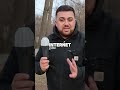
If you’re new to the channel, my name is Rami Tamimi. I’m a Professional Surveyor, Ph.D. candidate in Geodetic Engineering at The Ohio State University, and the founder of The Survey School.
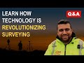
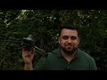
In this video, I break down how Network RTK works and explain the key acronyms every surveyor and geospatial professional should understand, including RTK, NTRIP, VRS, and CORS. I also show how a compact GNSS receiver like the Emlid Reach RX2 can connect to correction services over the internet and achieve centimeter-level accuracy with just one receiver.
We’ll cover how real-time kinematic positioning works, the role of base stations, how correction data is delivered through NTRIP, the difference between direct CORS access and VRS networks, and how all of this can be applied in real field workflows for surveying and mapping.
I spent the last decade obsessed with surveying and geospatial technology and the digital transformation of our world. On this channel, I showcase the latest workflows and technologies in the mapping industry while holding them to a high standard when it comes to accuracy, practicality, and real-world performance.
How I got here...
2008: My father was laid off as a Survey Crew Chief. He started his own business and took me out in the field to learn surveying with him.
2017: Bought my first drone, a DJI Phantom 3, off eBay for $499. Taught myself Pix4Dmapper and landed an aerial mapping internship that same summer.
2018: Graduated with my B.S. in Surveying Engineering and started in the field doing traditional boundary and topographic surveys.
2019: Finished my M.S. in Civil Engineering with a project management focus. At that point, I had a deep desire to learn more about geospatial technology and knew I was not done learning.
2020: Entered the Ph.D. program in Geodetic Engineering at Ohio State. That same year, I started this YouTube channel to document the journey.
2021: Hit 20,000 subscribers and secured my first major industry partnership with Emlid, proving there was a massive shortage of modern surveying content.
2022: Recruited by General Motors as an Advanced Technology Specialist, specializing in ground truthing and sensor alignment for autonomous systems.
2023: YouTube channel grew to 50,000+ subscribers. Expanded my network and partnered with over 30 of the top geospatial companies globally.
2024: The pivot. I was laid off from GM during corporate restructuring. Instead of immediately looking for a new job, I built The Survey School to create the educational platform and community this industry was missing.
2025: Scaled the school to 100+ active members and published my 10th peer-reviewed paper for my Ph.D., proving I could bridge the gap between academic research and practical field experience.
2026: Accepted a role as the Lead Geomatics Manager at WSP, overseeing multi-million dollar reality capture and infrastructure projects across the Midwest.
Today: I’m currently preparing to defend my dissertation at The Ohio State University to finalize my Ph.D.
My goal is simple: to make the world’s best geospatial education accessible to everyone. From the solo surveyor to the global enterprise, so we can map tomorrow’s world together.
If this video helped you, make sure to like, subscribe, and leave a comment telling me what topic you want me to break down next.
#NetworkRTK #GNSS #Emlid #NTRIP #RTK #CORS #VRS #LandSurveying #Surveying #Geomatics #GPS #Geospatial
Видео Network RTK for Beginners: NTRIP, VRS, and Centimeter Accuracy канала Rami Tamimi, P.S.
👉 https://thesurveyschool.com
🛰 Check out Emlid products here:
👉 https://store.emlid.com/rami
📍 Find your state’s NTRIP / RTK correction source here:
👉https://www.thesurveyschool.com/resources-ntrip
If you’re new to the channel, my name is Rami Tamimi. I’m a Professional Surveyor, Ph.D. candidate in Geodetic Engineering at The Ohio State University, and the founder of The Survey School.
In this video, I break down how Network RTK works and explain the key acronyms every surveyor and geospatial professional should understand, including RTK, NTRIP, VRS, and CORS. I also show how a compact GNSS receiver like the Emlid Reach RX2 can connect to correction services over the internet and achieve centimeter-level accuracy with just one receiver.
We’ll cover how real-time kinematic positioning works, the role of base stations, how correction data is delivered through NTRIP, the difference between direct CORS access and VRS networks, and how all of this can be applied in real field workflows for surveying and mapping.
I spent the last decade obsessed with surveying and geospatial technology and the digital transformation of our world. On this channel, I showcase the latest workflows and technologies in the mapping industry while holding them to a high standard when it comes to accuracy, practicality, and real-world performance.
How I got here...
2008: My father was laid off as a Survey Crew Chief. He started his own business and took me out in the field to learn surveying with him.
2017: Bought my first drone, a DJI Phantom 3, off eBay for $499. Taught myself Pix4Dmapper and landed an aerial mapping internship that same summer.
2018: Graduated with my B.S. in Surveying Engineering and started in the field doing traditional boundary and topographic surveys.
2019: Finished my M.S. in Civil Engineering with a project management focus. At that point, I had a deep desire to learn more about geospatial technology and knew I was not done learning.
2020: Entered the Ph.D. program in Geodetic Engineering at Ohio State. That same year, I started this YouTube channel to document the journey.
2021: Hit 20,000 subscribers and secured my first major industry partnership with Emlid, proving there was a massive shortage of modern surveying content.
2022: Recruited by General Motors as an Advanced Technology Specialist, specializing in ground truthing and sensor alignment for autonomous systems.
2023: YouTube channel grew to 50,000+ subscribers. Expanded my network and partnered with over 30 of the top geospatial companies globally.
2024: The pivot. I was laid off from GM during corporate restructuring. Instead of immediately looking for a new job, I built The Survey School to create the educational platform and community this industry was missing.
2025: Scaled the school to 100+ active members and published my 10th peer-reviewed paper for my Ph.D., proving I could bridge the gap between academic research and practical field experience.
2026: Accepted a role as the Lead Geomatics Manager at WSP, overseeing multi-million dollar reality capture and infrastructure projects across the Midwest.
Today: I’m currently preparing to defend my dissertation at The Ohio State University to finalize my Ph.D.
My goal is simple: to make the world’s best geospatial education accessible to everyone. From the solo surveyor to the global enterprise, so we can map tomorrow’s world together.
If this video helped you, make sure to like, subscribe, and leave a comment telling me what topic you want me to break down next.
#NetworkRTK #GNSS #Emlid #NTRIP #RTK #CORS #VRS #LandSurveying #Surveying #Geomatics #GPS #Geospatial
Видео Network RTK for Beginners: NTRIP, VRS, and Centimeter Accuracy канала Rami Tamimi, P.S.
Surveying Land Surveying Civil Civil Engineering Engineering Total Station GPS GNSS Boundary Topographic Boundary Survey Boundary Surveying Topographic Survey Stake out Staking Construction Construction Layout Layout Surveying Engineering Survey Leveling Leveling EDM Transit Geodesy Satellite Positioning Survey GPS emlid reach rs2 Drones Drone Survey Aerial Mapping LiDAR Drones UAS UAS Drones Drone Mapping RTK Drones iphone vidoc vidocrtk rtklidar pix4d
Комментарии отсутствуют
Информация о видео
13 марта 2026 г. 22:57:13
00:07:04
Другие видео канала