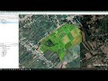
Levantamiento Topografico con Google Earth-Civil 3D🔥(TUTORIALCOMPLETO)
Se realizo el levantamiento topográfico usando coordenadas del Google Earth Pro luego se complemento con el apoyo de otros software como el Gps Visualizer, MapSource y el Excel para terminar importando los puntos al AutoCad-Civil 3D con una elaboración de plano final cpmpleto.
Видео Levantamiento Topografico con Google Earth-Civil 3D🔥(TUTORIALCOMPLETO) канала Gravedad Cero Perú
Видео Levantamiento Topografico con Google Earth-Civil 3D🔥(TUTORIALCOMPLETO) канала Gravedad Cero Perú
Показать
Комментарии отсутствуют
Информация о видео
Другие видео канала
 Levantamiento de predios agrícolas usando, Google Earth, Global Mapper y AutoCAD
 Tutorial AutoCAD Civil 3D: Creación de Plano Topográfico
 Curso rápido de Google Earth Pro
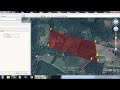 Cómo crear un POLÍGONO en Google Earth con coordenadas UTM de parcela ( pasó a paso)
 LEVANTAMIENTO TOPOGRÁFICO CON GOOGLE EARTH DEL RIO ICA
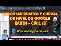 EXPORTAR PUNTOS Y CURVAS DE NIVEL DE GOOGLE EARTH - CIVIL 3D 2020.
 PROCESAMIENTO DE DATOS TOPOGRÁFICOS CON CIVIL 3D, IMPORTACIÓN DE PUNTOS Y CREACIÓN DE SUPERFICIES
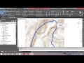 EXPORTAR CURVAS DE NIVEL DE GOOGLE EARTH A CIVIL 3D
 Como sacar curvas de nivel de Google earth para Autocad
 🌎 Como hacer TOPOGRAFIA 3D terreno y CURVAS de NIVEL | Sketchup Revit Google Earth Cad Global Mapper
 COMO GEORREFERENCIAR EN AUTOCAD CIVIL 3D 2020 / 2021 / 2022 CON GOOGLE EARTH PRO
 Como Georreferenciar planos topográficos con goolge earth
 Curvas de nivel con google earth en arcgis 2020
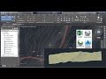 Perfil Alineamiento Desde Google Earth a AutoCAD Civil3D Y Obtención De Puntos En Excel
 Como transformar un mapa de Google a un croquis de Autocad o illustrator
 DISEÑO GEOMETRICO DE CARRETERA EN CIVIL 3D (Alineamiento,perfil,secciones transversales,volumenes)
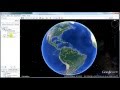 Google Earth 2016 - Obtener puntos con sus coordenadas UTM y elevación.
 TOPOGRAFIA - IMPORTACION AUTOMATIZADA DE PUNTOS + CIVIL 3D | TOPOGRAFÍA | FRANK NUÑEZ
 levantamiento topografico con google earth