Archeologists complete first ever LIDAR survey of ancient Mayan highway
For story suggestions or custom animation requests, contact tips@nextanimation.com.tw. Visit http://archive.nextanimationstudio.com to view News Direct's complete archive of 3D news animations.
RESTRICTIONS: Broadcast: NO USE JAPAN, NO USE TAIWAN Digital: NO USE JAPAN, NO USE TAIWAN
Archeologists have used laser scanning to chart an ancient 100 km long Mayan highway built 13 centuries ago. They say Coba, a powerful city-state, may have built the road to invade its neighbor Yaxuna. The study was published in the Journal of Archeological Science.
The University of Miami said in a news release that the study used light detection and ranging technology lasers to penetrate thick jungle vegetation and reveal the ruins beneath. The LIDAR survey mapped out the road and uncovered 8,000 structures on its path.
University professor Traci Ardren is cited as saying the road did not run straight as supposed. Instead, Coba's warrior queen K'awiil Ajaw may have built the winding road to control settlements across the Yucatan Peninsula and to attack Yaxuna.
Arden, who is a co-author, says the Mayan roads were an engineering marvel. Giant limestone boulders were utilized to fill uneven ground, then white plaster was applied to make the road surface. This substance is similar to Roman concrete and gave the road its name Sacbe, which comes from the Mayan word for "white way."
RUNDOWN SHOWS:
1. Sacbe 1 may have been built by Coba to invade Yaxuna
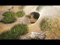
2. LIDAR survey penetrates vegetation to reveal ruins
3. Curving path of the road may have served Coba's geostrategic purposes
4. Highway construction by ancient Mayans
VOICEOVER (in English):
"Archeologists have used laser scanning to chart an ancient 100 km long Mayan highway built 13 centuries ago."
"They say Coba, a powerful city-state, may have built the road to invade its neighbor Yaxuna. The study was published in the Journal of Archeological Science."
"The University of Miami said in a news release that the study used light detection and ranging technology lasers to penetrate thick jungle vegetation and reveal the ruins beneath."
"The LIDAR survey mapped out the road and uncovered 8,000 structures on its path."
"University professor Traci Ardren is cited as saying the road did not run straight as supposed. Instead, Coba's warrior queen K'awiil Ajaw may have built the winding road to control settlements across the Yucatan Peninsula and to attack Yaxuna."
"Arden, who is a co-author, says the Mayan roads were an engineering marvel. Giant limestone boulders were utilized to fill uneven ground, then white plaster was applied to make the road surface."
"This substance is similar to Roman concrete and gave the road its name Sacbe, which comes from the Mayan word for 'white way.'"
SOURCES: Journal of Archeological Science, University of Miami
https://www.sciencedirect.com/science/article/pii/S2352409X19306662?via%3Dihub
https://news.miami.edu/stories/2020/02/modern-technology-reveals-old-secrets-about-the-great-white-maya-road.html
***
------------------------------------------------------------------------------------------------
Next Animation Studio’s News Direct service provides daily, high-quality, informative 3D news animations that fill in for missing footage and help viewers understand breaking news stories or in-depth features on science, technology, and health.
Sign up for a free trial of News Direct's news animations at http://newsdirect.nextanimationstudio.com/trial/
To subscribe to News Direct or for more info, please visit:
http://newsdirect.nextanimationstudio.com
Видео Archeologists complete first ever LIDAR survey of ancient Mayan highway канала News Direct
RESTRICTIONS: Broadcast: NO USE JAPAN, NO USE TAIWAN Digital: NO USE JAPAN, NO USE TAIWAN
Archeologists have used laser scanning to chart an ancient 100 km long Mayan highway built 13 centuries ago. They say Coba, a powerful city-state, may have built the road to invade its neighbor Yaxuna. The study was published in the Journal of Archeological Science.
The University of Miami said in a news release that the study used light detection and ranging technology lasers to penetrate thick jungle vegetation and reveal the ruins beneath. The LIDAR survey mapped out the road and uncovered 8,000 structures on its path.
University professor Traci Ardren is cited as saying the road did not run straight as supposed. Instead, Coba's warrior queen K'awiil Ajaw may have built the winding road to control settlements across the Yucatan Peninsula and to attack Yaxuna.
Arden, who is a co-author, says the Mayan roads were an engineering marvel. Giant limestone boulders were utilized to fill uneven ground, then white plaster was applied to make the road surface. This substance is similar to Roman concrete and gave the road its name Sacbe, which comes from the Mayan word for "white way."
RUNDOWN SHOWS:
1. Sacbe 1 may have been built by Coba to invade Yaxuna
2. LIDAR survey penetrates vegetation to reveal ruins
3. Curving path of the road may have served Coba's geostrategic purposes
4. Highway construction by ancient Mayans
VOICEOVER (in English):
"Archeologists have used laser scanning to chart an ancient 100 km long Mayan highway built 13 centuries ago."
"They say Coba, a powerful city-state, may have built the road to invade its neighbor Yaxuna. The study was published in the Journal of Archeological Science."
"The University of Miami said in a news release that the study used light detection and ranging technology lasers to penetrate thick jungle vegetation and reveal the ruins beneath."
"The LIDAR survey mapped out the road and uncovered 8,000 structures on its path."
"University professor Traci Ardren is cited as saying the road did not run straight as supposed. Instead, Coba's warrior queen K'awiil Ajaw may have built the winding road to control settlements across the Yucatan Peninsula and to attack Yaxuna."
"Arden, who is a co-author, says the Mayan roads were an engineering marvel. Giant limestone boulders were utilized to fill uneven ground, then white plaster was applied to make the road surface."
"This substance is similar to Roman concrete and gave the road its name Sacbe, which comes from the Mayan word for 'white way.'"
SOURCES: Journal of Archeological Science, University of Miami
https://www.sciencedirect.com/science/article/pii/S2352409X19306662?via%3Dihub
https://news.miami.edu/stories/2020/02/modern-technology-reveals-old-secrets-about-the-great-white-maya-road.html
***
------------------------------------------------------------------------------------------------
Next Animation Studio’s News Direct service provides daily, high-quality, informative 3D news animations that fill in for missing footage and help viewers understand breaking news stories or in-depth features on science, technology, and health.
Sign up for a free trial of News Direct's news animations at http://newsdirect.nextanimationstudio.com/trial/
To subscribe to News Direct or for more info, please visit:
http://newsdirect.nextanimationstudio.com
Видео Archeologists complete first ever LIDAR survey of ancient Mayan highway канала News Direct
Показать
Комментарии отсутствуют
Информация о видео
Другие видео канала
 Florida now home to venomous new tarantula species
 Oil spill off Singapore caused by collision of Alyarmouk oil tanker and Sinar Kapuas bulk carrier
 British climber 'swims' his way out of Mont Blanc avalanche
 At least 73 people killed in Afghanistan bus crash as vehicles engulfed in flames
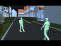 Man kills family: Swiss gunman shoots in-laws in murder-suicide over family dispute
 UPDATE: Ex-Miss Venezuela, ex-husband murdered in car in Venezuela
 Malaysia Second Penang bridge collapses on vehicles: four feared dead (Update)
 Afghan policeman sacrifices self to shield others
 Assassinated President’s Wife Says Guards Had Orders to Stand Down
 Nogales Arizona: the world's narco-tunnel capital
 World Cup 2014: Brasilia's Mane Garrincha stadium the first net zero energy stadium
 Bob Saget Head Injury Like ‘Baseball Bat to the Head’ or Someone Who Had Fallen 30 Feet
 Mummified body found Mexico’s tallest mountain, Pico de Orizaba
 Freight train slams into car, killing a driver
 Thai cameraman killed in highway accident while filming news segment
 Brain-controlled exoskeleton will allow paralyzed teenager to kick off the World Cup 2014
 Evacuated Tube Transport could take you around the world in just 6 hours
 Thousands of Burning Porsches, Lamborghinis Sink With Ship
 World's largest iceberg breaks into smaller chunks near South Georgia
 Taliban kills 'Pakistan's toughest cop' in Karachi car bomb
 Scientists to turn bacteria in 'bio-batteries'