A history of Charing Cross in maps
The story of Charing Cross and Trafalgar Square illustrated in a series of historical maps between the 1500s and modern day. We visit the Royal Mews - more birds of prey than horses; see two Eleanor Crosses; drop by an ancient priory and watch as a new public space is built.
Видео A history of Charing Cross in maps канала The Underground Map
Видео A history of Charing Cross in maps канала The Underground Map
Показать
Комментарии отсутствуют
Информация о видео
Другие видео канала
 Everyday secrets lost to time
 The First World War camera crew that witnessed a Zeppelin raid
 The first day of the London trolleybus
 Hounslow's Fiery Days
 Walking the London tube: Waterloo to Embankment
 The nearly unknown bit of garden loveliness
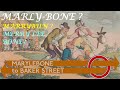 Walking the London tube: Marylebone to Baker Street
 Shortest walk on the Tube. Or is it?
 An allowed diagonal according to the rules
 Burnt Oak’s Watling Estate
 Walking the London tube: Upminster Bridge to Hornchurch
 Gaily runs the red electric train
 Where you can still come and make eyes at me
 London books that pack in the information
 The Amersham photos of George Ward
 First day of the Elizabeth Line
 The gorgeousness of the Thames in Hammersmith
 Docklands industrial heartland
 The glorious street photos of Roger Mayne
 Futility (Wilfred Owen)