Drone Topographic Survey - Creating DSM/DEM To Create Contour Maps For Construction
An introduction to creating a topographic survey using a drone.
https://www.constructiondroneservices...
Topographic surveys using a survey rover pole have conventionally been a laborious task. Photogrammetry from drones offers an alternative method and using GCPs (Ground Control Points) there is still acceptable accuracy achievable.
Видео Drone Topographic Survey - Creating DSM/DEM To Create Contour Maps For Construction канала Construction Drone Services
Показать
Комментарии отсутствуют
Информация о видео
6 апреля 2020 г. 18:13:23
00:10:30
Другие видео канала
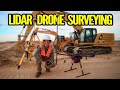 What is LiDAR Drone Surveying | Accuracies and Results
 How to extract contour lines And DEM from Google Earth
 Drone Survey & AutoCAD: How to Import Orthomosaic/Orthophoto and basic measurements
 Topografie cu drona profesionala Phantom RTK
 Topographic Surveys 101: A Beginner's Guide
 Job Shadow: Drone survey & stockpile volume measurements
 TOPOGRAPHIC SURVEYS | Topography | Topographic Maps | Civil Engineering & Construction
 Drone Deploy Mapping Demo Tutorial | DJI Mavic Pro
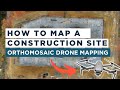 Drone Mapping for Construction: Complete Guide
 Terrain Mapping Demo with DJI Zenmuse L1
 DJI Mavic 2 Enterprise Advanced Thermal Drone - YOU Won't Believe How Easy You Can Make Money!
 Aerial Photogrammetry Explained - Create 3D Models With Drone Photos
 Generating XYZ tiles(MBTiles) in QGIS # Lesson 28 of 29 # QGIS Tutorial.
 eBee RTK - The Survey-Grade Mapping Drone
 Aerial Mapping with the Autel EVO II
 how to create contour by global mapper
 Drone Surveying for Beginners
 Understanding Contour Lines
 DJI Mavic Mini - Review for Survey and 3D Modelling
 Topographic Survey Using a Drone (Old Version)