Topographic Surveys 101: A Beginner's Guide
What is a Topographic Survey?
https://retipster.com/terms/topographic-survey/
Topographic surveys are trigonometrically calculated, map-based representations of the earth. The calculations are done by a surveyor to give an approximation of the earth's surface. These surveys provide basic information for land planning, development, and infrastructure construction.
The surveyor calculates the elevations in relation to a selected datum or datums (mean sea level) and their position on the earth's surface. The topographic survey is a three-dimensional graphical representation of the features and elevations of a parcel of land.
Learn more about land surveys: https://retipster.com/terms/landsurvey/
The surveyor from this video: https://roosien-assoc.com/
Table of Contents
0:00 - Intro
0:06 - What is a topographical survey?
0:33 - What are the measurements taken in a topo survey?
0:47 - What tools does a surveyor use for a topo survey?
1:21 - How accurate and reliable is a topo survey?
2:02 - How reliable is Google Earth for finding ground elevations?
2:36 - How many points of measurement are taken on a topo survey?
2:57 - How long does it take to complete a topo survey?
3:04 - What affects the cost of a topo survey?
3:35 - How does a normal topo survey compare to an unmanned drone LiDAR survey?
3:53 - Is a drone LiDAR survey less expensive than a traditional topographical survey?
4:03 - What is the purpose of a topo survey?
4:22 - Do people ever start building without a topo survey?
5:02 - How steep is too steep to build?
5:12 - What does a topo survey NOT tell you?
Follow Along!
YouTube: https://retipster.com/youtube
Facebook: https://www.facebook.com/retipster
Instagram: https://www.instagram.com/retipster
Twitter: https://twitter.com/retipsterblog
Twitter: https://twitter.com/retipsterseth
Pinterest: https://www.pinterest.com/REtipster
LinkedIn: https://www.linkedin.com/company/retipster
Видео Topographic Surveys 101: A Beginner's Guide канала REtipster
Показать
Комментарии отсутствуют
Информация о видео
Другие видео канала
 Topographic Surveying for Beginners
 Life of a Land Surveyor: Episode 1
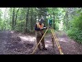 #174 Blazing New Trails! Part 1. Surveying the property lines and boundaries. trail building.
 HOW TO SET ELEVATION BASED OFF OF A HUB || How to take elevation using a grade rod and a laser
 What is LiDAR Drone Surveying | Accuracies and Results
 HOW TO READ TOPOGRAPHIC MAPS // Basic Land Navigation Part 1
 How High-Res Space Imagery Will Change Everything | 10CM Satellite Imagery Explained
 As a land investor, every day is a good day.
 Quick & Easy Topographic / Contour Vector Maps For Laser Cutting | How to | Tutorial
 How to Get Free Topo Maps - Map and Compass Skills - Video 1
 Profile and crosssectional Levelling : Surveying Practical
 The Anatomy of a Land Deal (A Comprehensive Case Study)
 Surveying 2 - Lecture 2 - Topographic Surveying
 What Really Happened at the Hernando de Soto Bridge?
 How to Plot CONTOURS on a SURVEY PLAN with REDUCED LEVEL(R.L.) Points/ Interpolation of CONTOURS
 5 Incredible Examples of Ancient Engineering
 Why You Need A Land Survey
 WELL DRILLING 101 | Every Step Explained
 How does land surveying work?