RUS webinar: Coral reef monitoring with Sen2Coral - OCEA05
During this webinar, you will learn how to process Sentinel-2 data for coral reef monitoring. We will demonstrate the several processing chains and operators available within the Sen2Coral tool.
CHALLENGE YOURSELF with our E-Learning courses available on the RUS training platform: https://rus-training.eu/course
Follow the remote sensing theory courses explained by our experts and test your knowledge through the online questions at the end of each video!
Видео RUS webinar: Coral reef monitoring with Sen2Coral - OCEA05 канала RUS Copernicus Training
Показать
Комментарии отсутствуют
Информация о видео
Другие видео канала
 RUS Webinar: Crop mapping with Sentinel-2 - LAND01
 RUS Webinar: Rice detection with Sentinel-1 using SNAP GPT - LAND10
 Scientists Are Breeding Super Coral That Can Survive Climate Change
 Mapping Reef Health: Using Photogrammetry and 3D Models to Monitor and Visualize Coral Reefs
 Copernicus for GI: Copernicus for High-Resolution Mapping of Water Quality
 RUS Webinar: Oil spill mapping with Sentinel-1 - OCEA03
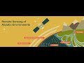 NASA ARSET: Fundamentals of Aquatic Remote Sensing
 Some cool stuff with remote sensing on Heron Reef
 Creating Bathymetric Data for a Freshwater Reservoir using Satellite Imagery
 RUS webinar: Monitoring volcanic emissions with Sentinel 5p - ATMO03
 eCognition Webinar: Coral Reef and Seagrass Habitat Mapping using Object Based Analysis
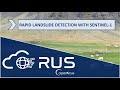 RUS webinar: Rapid Landslide Detection with Sentinel-1 - HAZA07
 Methods for cropland/crop type mapping from S2 and/or S1 time series - Day 2.2
 ESA Echoes in Space - Hazard: Flood mapping with Sentinel-1
 ESA Echoes in Space - Land: Urban Footprint mapping with Sentinel-1
 How to Conduct a Coral Reef Survey
 RUS webinar: Lithological classification with Sentinel-1 & Sentinel-2 - GEOL01
 RUS Webinar: Land Subsidence mapping with Sentinel-1 - HAZA03
 RUS Webinar: Mapping waterbodies from space - HYDR01
 RUS webinar: Sea Ice Monitoring with Sentinel-1 - CRYO04