Mapping with Measure Ground Control and DJI's Phantom 4 Pro v2
In this video I cover how to make a 2D, orthomosaic map using a DJI Phantom 4 Pro drone and Measure Ground Control software.
Topics include registering with Measure, planning a flight, modifying settings, flying the mission, and processing the captured images. I also look at what you can do with the final product, including how to work with layers and taking measurements.
Thanks for viewing and please don't forget to like and subscribe.
Видео Mapping with Measure Ground Control and DJI's Phantom 4 Pro v2 канала Wild Wonderful Weekends
Показать
Комментарии отсутствуют
Информация о видео
16 октября 2021 г. 9:11:05
00:14:20
Другие видео канала
 Drone Surveying for Beginners
 Drone Mapping with Pix4D Capture
 Step 2 - Phantom 4 Pro Plus Remote - Pix4D USB Issue SOLVED!
 How to build a SUCCESSFUL Drone Mapping business in 2022 - Drone Deploy
 Mavic 2 Pro vs. Phantom 4 Pro In-Depth Comparison
 Drone Mapping for Construction: Complete Guide
 I MADE $93,715 IN 6 MONTHS with my Drone - Drone Photogrammetry
 3D MAPPING with a DJI Phantom & Drone Deploy
 DJI Mavic Air 2 Mapping Mission - Dronelink + Maps Made Easy
 PHANTOM 4 RTK | Everything You Should Know | FULL REVIEW AND TEST
 DJI Phantom 4 Pro | Best Video, Photo and Gimbal Settings
 Mapping with Measure Ground Control
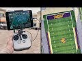 Beginner Tips for Drone Mapping - My Workflow
 DJI Phantom 4 Pro Version 2 Draw route function
 Ultimate Pix4D tutorial 3D mapping
 Processing Drone Images with GCPs using Pix4D Mapper
 Pix4d, Litchi connect to Phantom 4pro plus controller
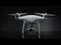 DJI – Introducing Phantom 4 Pro
 DJI Tutorials - Phantom 4 Pro - How to Fly - Debut Flight/Flight Modes
 How Waypoints work on then Phantom 4 Pro V2.