Print Layout in QGIS 3
This video shows how to use the Print Layout in QGIS 3.
This video is part of IHE Delft OpenCourseWare. More free resources can be found at http://www.gisopencourseware.org
For an overview of our GIS courses and info on tailor made trainings and advise see our folder: https://www.un-ihe.org/sites/default/files/2019_qgis_certification_programme_0.pdf
More information about the book "QGIS for Hydrological Applications - Recipes for Catchment Hydrology and Water Management" by Kurt Menke and Hans van der Kwast can be found at the website of Locate Press: http://www.locatepress.com/hyd
IHE Delft and Nieuwland Geoinformatie offer an online course. It includes support from experienced trainers and you'll get the official QGIS certificate after completion. More info at: http://www.learning-gis.com
Subscribe to the YouTube Channel for updates!
Credits for OpenStreetMap data: © OpenStreetMap contributors
Видео Print Layout in QGIS 3 канала Hans van der Kwast
Показать
Комментарии отсутствуют
Информация о видео
Другие видео канала
 How to Make a Map using QGIS3
 QGIS Basics Printing
 QGIS Basics #15: Layout Manager Adding Maps, Using Scale, and Locking Maps
 QGIS 3 for Absolute Beginners
 Stream and catchment delineation in QGIS 3
 QGIS Contours and Contour Labels
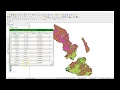 Calculate percentage of land use per subcatchment in QGIS 3
 QGIS Print Composer Lock Maps | burdGIS
 Importing CSV (Excel) Coordinates into QGIS
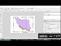 QGIS | Grid & Coordinates Addition
 QGIS Calculating Volumes
 An Absolute Beginner's Guide to QGIS 3
 Deriving River Network & Catchments from a DEM using QGIS
 Georeferencing in QGIS 3 | burdGIS
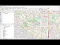 Extracting Data from OpenStreetMap using QGIS & QuickOSM
 QGIS: Map Layouts
 Demo 14 – Making Maps in QGIS with the Print Layout (Pt. I)
 Adding and Editing a Legend in QGIS 3.10
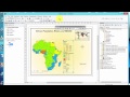 ArcGIS Create A Map Layout