Dynamic Stream Permanence Estimates at Local and Regional Extents
Topic: Dynamic Stream Permanence Estimates at Local and Regional Extents
Speaker: Konrad Hafen, USGS
In the United States (US), the frequency and duration of surface water in a stream channel (i.e. stream permanence) determines if a stream is subject to regulation under the Clean Water Act. The most comprehensive dataset of stream permanence classifications for the US is the National Hydrography Dataset (NHD), which has been shown to exhibit high rates of disagreement with in situ stream permanence observations. Analysis of NHD stream permanence disagreements with in situ observations indicates that differences in climate conditions between observation years contribute to the NHD disagreements and supports the need for dynamic simulation of stream permanence based on climate.
In this study, two differing hydrological models were implemented to generate dynamic stream permanence estimates at a regional and local extents. In the Pacific Northwest (PNW) the Thornthwaite monthly water balance model (MWBM) was implemented to generate stream permanence estimates for headwater streams in the NHD network from 1977-2019. In the HJ Andrews Experimental Forest and Willow and Whitehorse watersheds of Oregon, the Watershed Erosion Prediction Project (WEPP) hydrologic model was applied to simulate stream permanence from 2011-2017. On 40% of PNW headwater streams no MWBM parameter sets were greater than 65% accurate when compared to observations. On 60% of headwater streams the MWBM dynamically simulated stream permanence with varying precision. Additional data would encourage and inform further model development. WEPP simulations produced daily stream permanence accuracies up to 93% and annual stream permanence accuracies up to 87% but different parameter sets performed better for daily and annual time steps.
These results indicate that, when implemented for stream permanence simulation, assessment of physically-based models should include both daily and annual accuracies. Additionally, future stream permanence data collection methods and methodologies should be strategically planned to capture the spatiotemporal dynamics of stream permanence that are required to effectively develop and evaluate models.
Links:
The influence of climate variability on the accuracy of NHD perennial and non-perennial stream classifications: https://pubs.er.usgs.gov/publication/70212559
Streamflow Observation Points in the Pacific Northwest, 1977-2016: https://www.sciencebase.gov/catalog/item/5a0f338de4b09af898d099b9
Video: https://www.usgs.gov/media/videos/dynamic-stream-permanence-estimates-local-and-regional-extents
Видео Dynamic Stream Permanence Estimates at Local and Regional Extents канала USGS
Показать
Комментарии отсутствуют
Информация о видео
Другие видео канала

 Mount St. Helens: May 18, 1980
 PubTalk-11/2021: Busting Myths About One of the Largest Volcanic Systems in the World
 Colorado River: Spring Disturbance Flow
 Monthly update of activity at Yellowstone Volcano for June 2021
 Kīlauea Summit Eruption | Lava Returns to Halemaʻumaʻu
 USGS Coastal Change Hazards
 November (2021) Yellowstone Volcano
 Status of (mostly) WA Volcanoes: Report to Emergency Managers 2020-21
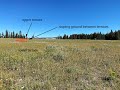 Yellowstone's ups and downs - monthly update of activity at Yellowstone Volcano (December 1, 2021)
 Overflow of a perched levee—Halema‘uma‘u, Kīlauea summit
 Kīlauea Volcano — Lava Scenes From Fissure 8
 EarthShots — Satellite Images of Environmental Change
 What Does a USGS Hydrologic Technician Do to Inspect Streamgages?
 Rockfall, Cliff Retreat in Yosemite Valley since Last Glacial Maximum
 PubTalk - 6/2021: Mount St. Helens Revisited
 IRIC Pilot Applications for the Potomac River Using Bathy-Lidar Data
 The Yellowstone Volcano: Past, Present and Future
 Lava sloshing and spattering in west vent in Halema‘uma‘u crater at Kīlauea volcano
 Image of the Week - Historic Lows at Lake Powell