Hurricane Katrina: 7 BIG changes since August 29, 2005
A lot can change in 10 years.
It's been that long since Hurricane Katrina - the most expensive and one of the deadliest hurricanes to ever hit the United States.
Here are 7 big changes since August 29, 2005.
• Population has bounced back - mostly. Before Katrina - The New Orleans Metro Area was nearly 1.4 million. After - only a little more than a million mostly because people who evacuated never returned. And now, the population is up to one and a quarter million.
• The National Hurricane Center began issuing seasonal hurricane outlooks in 2008 to better prepare everyone for the upcoming season
• Better forecast models with reduced errors, better hurricane intensity forecasting, and better track forecasting. The average 48 hour track error in 2005 - 110 nautical miles. In 2014 - 65 nautical miles. In other words, today's 3-day forecasts are as accurate as 2-day forecasts in 2005.
• We now use drones to inspect hurricanes! The Coyote unmanned aircraft system flies in the lower part of a hurricane, where it is too dangerous for the hurricane hunter aircraft to go. It measures air pressure, temperature, moisture, sea-surface temperatures and wind speed inside the storm. These observations should help reveal how a hurricane pulls energy from the ocean—and improve predictions of intensity.
• In 2010, National Hurricane Center forecasts have been extended from 3 to 5 days, and watches and warnings are issued 12 hours sooner - to 48 hours ahead of time for a watch and 36 hours in advance for a warning. Tropical weather outlooks have been extended from 2 to 5 days.
• Beginning in 2015, storm surge watches and warnings are now getting issued in coastal communities. These provide a forecast to how high waves will be crashing on the shore. Storm surge kills more people than any other aspect of hurricanes.
• In 2005, Satellites were able to provide one image every five minutes. Next year, a new generation of satellites will launch, providing one image every 30 seconds during a major storm.
Katrina is the big hurricane everyone remembers, but 2005 was the most active hurricane season on record with 27 named storms. It was the first time the National Hurricane Center had to use "V" and "W" names, then use the Greek Alphabet when the names ran out.
2005 is also the last time a major hurricane - category 3, 4, or 5 - made US landfall when Wilma moved across Florida.
Thankfully, the last 10 years have been relatively quiet by comparison with a few exceptions.
Thanks for watching. Please leave your comments below. Like the video, and subscribe to our channel.
Find Storm Shield elsewhere on the internet:
http://www.stormshieldapp.com
http://www.facebook.com/stormshieldapp
http://twitter.com/StormShieldApp
Download the Storm Shield App:
iPhone: http://bit.ly/stormshieldapp-ios30
Android: http://bit.ly/stormshieldapp-android
Видео Hurricane Katrina: 7 BIG changes since August 29, 2005 канала Storm Shield App
Показать
Комментарии отсутствуют
Информация о видео
Другие видео канала
 Year in Review: Weather 2017
 2005 Atlantic Hurricane Season Animation V.5
 Hurricane Katrina damage - aerials of Mississippi destruction
 California's Great Flood of 1862
 10 Years After Katrina, Has New Orleans Been Rebuilt, Or Just Gentrified?
 Hurricane Katrina Before, After & Now: Biloxi Volume II
 Hurricane, Tornado, Cyclone – What’s the Difference?
 Hurricane Forecast 2017
 Top 5 Hurricane Eye Walls - Incredible
 Can you stop a hurricane?
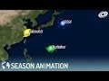 2000 Pacific Typhoon Season Animation
 Hurricane Florence, the storm's first strike
 South Dakota Derecho Intercept May 12, 2022 Sped Up Version
 Remembering Hurricane Katrina 10 years later
 8/29/2005 Hurricane Katrina, New Orleans, LA - Canal Street and Camp St. Katrina Raw Master 17
 2019 What-might-have-been Atlantic hurricane Season Animation
 8/29/2005 Hurricane Katrina, Biloxi, Mississippi, Part 2.
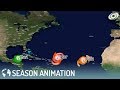 2010 Atlantic Hurricane Season Animation V.2
 LIVE: Nicholas strengthens to hurricane ahead of Texas landfall
 2029 North Atlantic Hypothetical Hurricane Season | Series 1 | #StormBoy1994