How to Download Satellite image or Google Maps | SAS Planet 2020
In the video, I will go through the SAS Planet software which can be used to Download any Settelite image which is freely available on the Internet eg: Google Maps, Bing Maps, ESRI satellite imagery, Nokia and much more.
Software Link: https://gisenglish.geojamal.com/2018/06/download-sas-planet-nightly-all.html
Language ISO names: http://www.mathguide.de/info/tools/languagecode.html
Видео How to Download Satellite image or Google Maps | SAS Planet 2020 канала GIS DevOps
Software Link: https://gisenglish.geojamal.com/2018/06/download-sas-planet-nightly-all.html
Language ISO names: http://www.mathguide.de/info/tools/languagecode.html
Видео How to Download Satellite image or Google Maps | SAS Planet 2020 канала GIS DevOps
Показать
Комментарии отсутствуют
Информация о видео
Другие видео канала
 Download High Resolution Google Earth Image from SAS Planet II SAS Planet Tutorial
 GIS Map Hik-Central
 SAS PLANET how to download satellite images free
 SAS Planet 2020: Télécharger les images satellitaire avec Haute résolution HD
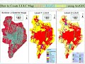 How to create Level-I, Level-II, and Level-III Land Use Land Cover(LULC) map using ArcGis.
 Download high resolution satellite maps and images free in SAS Planet
 how to download Google Earth images very high resolution using Sasplanet
 HOW TO GEOREFERENCE A GOOGLE EARTH IMAGE IN ARCGIS SOFTWARE
 Downloading satellite images using Sas Planet with very high résolution for free
 Lecture 55 : Different sources of free satellite images
 Download Very High Resolution Georeferenced Satellite Image
 How to get the most current satellite imagery
 ArcGIS Create A Map Layout.
 حمل صور جوية حديثة Sas planet how to download high resolution satellite image 2017
 Very High resolution Imagery from Google Earth- Best Method
 Download Landsat 9 Imagery for free
 تغيير لغة أسماء الأماكن على برنامج SAS Planet لأي لغة أخرى
 SAS.Planet - Part I - Download satellite imagery from ArcGIS Imagery, Google, etc..
 Cara georeferencing Peta Citra Google Earth di ArcGIS | Georeferencing Google Earth Image In ArcMap
 download very hight resolution satellite image tif from SASPLANET